The Trek to the Underground River

Underground-River
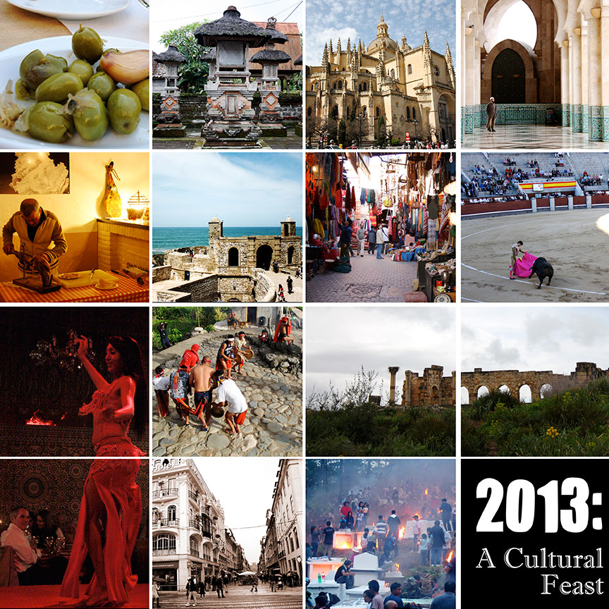
Credits: Papers by Plum Dumpling Designs, Pri Rocha, The Design Girl, Trixie Scap Design; Ribbon by Design by Tater, Red string with flowers by Graham Like the Cracker, and String wrap by Haynay Designs. 

Elusive in the past, I became disinterested and eventually gave up the idea of visiting Palawan’s famous Underground River. Then they re-opened the Jungle Trail.

Initially slated for December but due to unforeseen reasons, we moved our Puerto Princesa trip to January.  We planned to simply chill out, visit our favorite jaunts and catch up with friends. Then, the grand idea— “why not go to Sabang for the day so you can finally see the Underground River?” Anton to me.  Me to him,  “Ok, but we will trek to the cave.”

Sabang-Pier

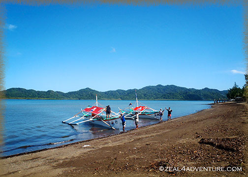
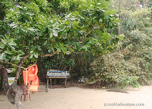
The Sabang Pier is the main jump off point to the Underground River or The Puerto Princesa Subterranean River National Park, once also called the St. Paul Subterranean River. Yes, it has many names. A UNESCO World Heritage Site since 1999, the cave was provisionally chosen (through votes—and you know how we Filipinos can vote) as one of the 7 New Wonders of Nature in 2011.

Entrance-from-the-shore
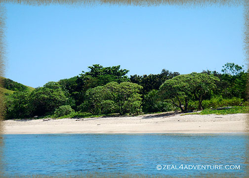
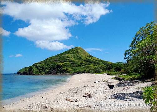
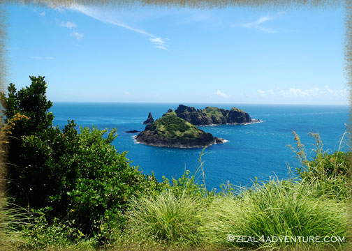
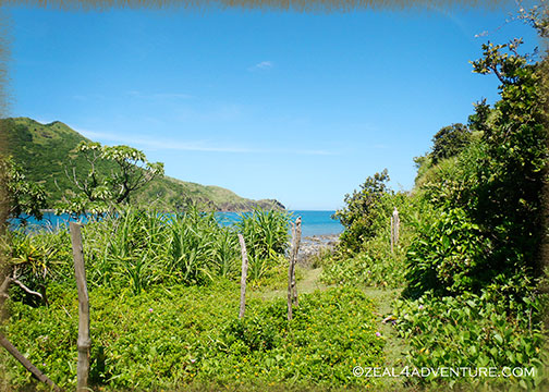
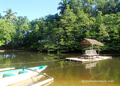
Entrance from the shore

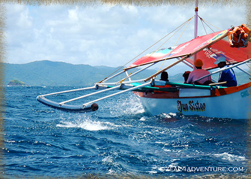
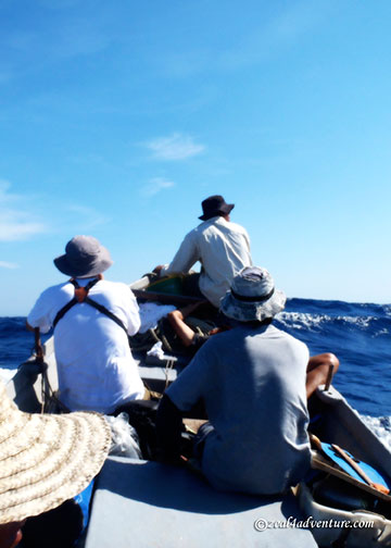
The usual way to get there is to take a 15-20 minute boat ride (I estimate) from the pier.

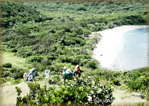
There are two trails to the cave, The Monkey Trail, and the Jungle Trail. The former has been closed for a time now and the latter re-opened only last year. Having heard of the Monkey trail from friends who did it some 10 years back, I knew that I’d do it at some point. Well, the jungle trail, I reckon, is good enough.

crossing
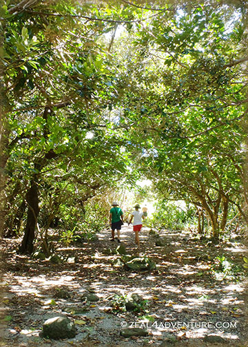
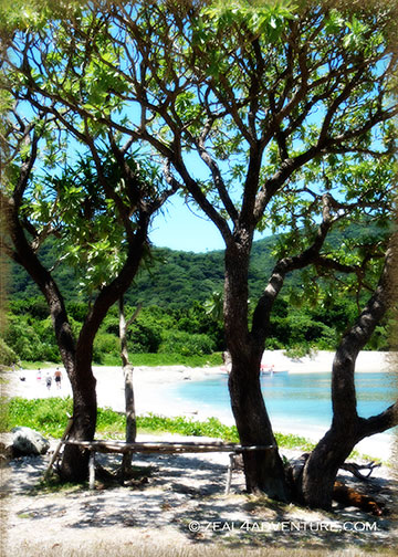
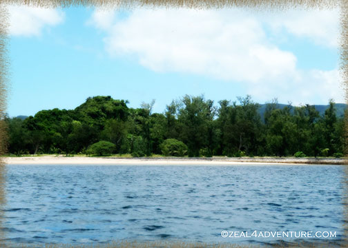
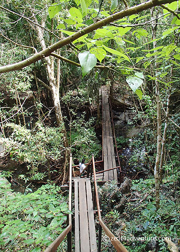
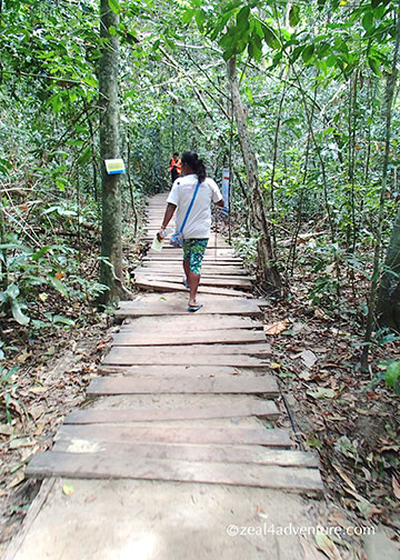
The trek starts by crossing the mangrove.

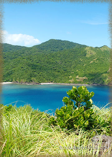
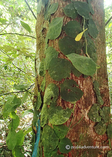
A recommended option for the active, the jungle trail meanders through a beautiful lush forest.

dwarfed-by-trees

It lets you hike through ancient trees, well crafted wooden staircases, bridges and benches made from confiscated wood that adds character to the trail

wooden-walkways

one-among-many-bridges

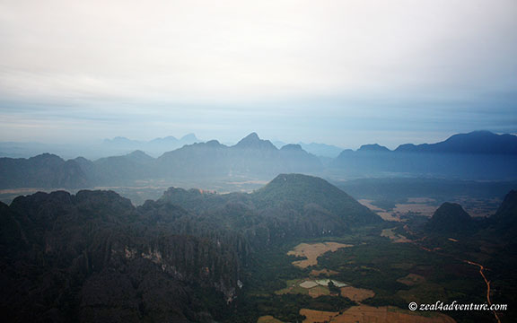
and at one point, limestone formations becomes backdrop behind the foliage.

limestone-backdrop

Not only does the pleasant 2-hour hike enhance the experience but it also gives jobs to the 20 or so Tagbanua indigenous community members.

guide

reminder-before-the-trek

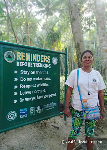
As “Park Wardens” they serve as guides and caretakers of the jungle.

path-to-the-river
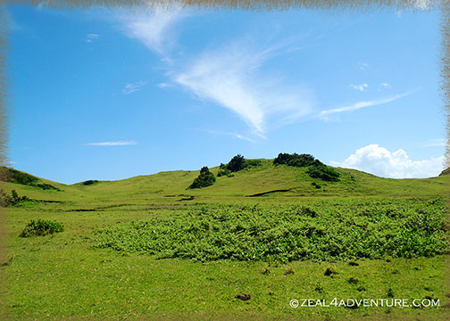
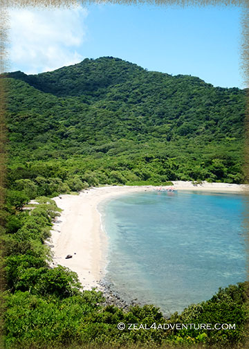
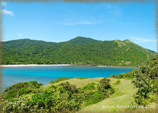
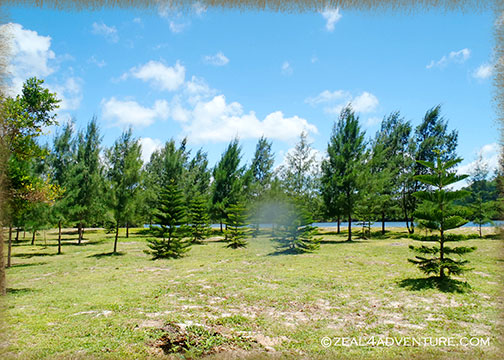
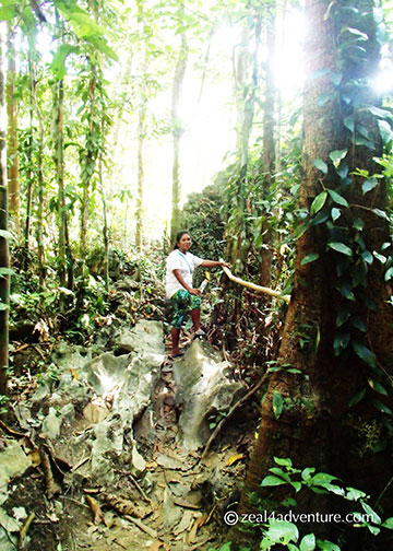
the path from the trail

The Underground River itself was not a let down at all. Having heard of so many mixed reviews, expectations were low.

paddle-boats
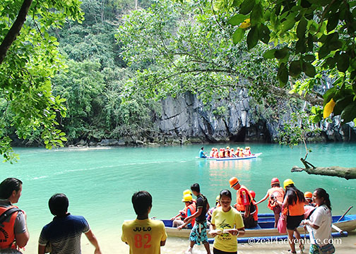
Waiting in line to enter the cave.

But to my surprise, the chambers especially the one called “the cathedral,” towering some 800 meters high, impressed me.

inside-the-cave

Truth to tell though, I fell asleep some part of the way, perhaps due to exhaustion and the fact that the only thing lighting the way was a flashlight held by the person in front. Our guide was adept and quite engaging in providing intelligent albeit elementary information about what a cave system is.

lush-forest-2

My take on this experience: to go there just for the Underground River may not be worth the effort (it’s still a 2-hour ride to Sabang). The hikes makes the difference.  Having seen Sabang, I wish I had stayed a few nights to explore the quiet town.

Advertisement

How Time Flies…

Has it been a year already?  According to WordPress, I made 23 new posts this year.  Really?  Only 23?  That’s about 2 posts a month, and half of what I posted in 2012.  Not good at all.  I can’t say if I will do better than last year, but I can at least promise to strive for it.

2013 was pretty good to me—in both the travel and work scene.  In the travel category, it has been a cultural feast near and far with Morocco, most definitely, topping the list, followed by Spain and Portugal.  But not to be outdone are some of the places close to me.  Here’s a glimpse of how I spent my 2013, many of which I still owe a post so please stay tune.

2013And with this, I wish you all a year of greater adventures and good health.  Cheers!!

The Way to Initiate the Novice

trekking-to-lighthouse

I’m with some novice trekkers, not that I mind, it is an easy trek after all.  I am thrilled, in fact, to have them experience the joy of summiting after an uphill struggle that seemed never-ending and pointless, and to realize, after all that trouble, that the reward is usually at the peak.

Named the 3rd best beach and island of the Philippines by CNN Go April of last year and just like that, Palaui caught my attention.  I’ve been going back and forth to Sta. Ana for a few years now, but Palaui was never on my radar.

rough-sea

Maybe because it takes more work to get there and that includes braving the (sometimes) treacherous sea.

approaching-palaui

A protected area, the island lies between the South China Sea and the Pacific Ocean.  It boasts of a nice long stretch of white pebble beach, abundant marine life, a century old lighthouse, a waterfalls hidden somewhere and a scenic rugged terrain.  It is pretty much uninhabited, with only a small community living in the island.  No electricity and accommodation to speak of.

jump-off

So one fine day, along with the same people I spent several Sta. Ana weekends together, we took off from the shores of Sun City in San Vicente and headed to Palaui.  An hour, perhaps more on the boat and we arrived on the island.

Palaui-beach-front

We paid for a guide and started our trek on the beach,

forest

which lead to a short forest walk before we emerged on the other side to beautiful rolling hills reminiscent of Batanes.

like-batanes

steps-to-lighthouse

We then climbed (more than) some steps that would eventually lead to the summit where Cape Engaño stands.

closer-glimpse-of-lighthouse

cape-engano

The view along the way took my breath away.

beach-from-the-top

It may not be the best beach as it is not fine sand as that of Boracay or even Palawan

beach

but the island dazzles at every turn,

dos-hermanas

glimpse-of-the-beach-on-the-way

from the beach to the top of the lighthouse… all I can say was SPECTACULAR.  And the new recruits were enjoying themselves too.

half-way-to-lighthouse

Not that difficult to get to, we took the Lugunzad trail, which took all of just 30 minutes from beach to lighthouse.

P6300834

There is a waterfall somewhere, said our guide, but all this walking made the others hungry.  And so the initiation is over, we will take baby steps and insist on the waterfalls some other time.

gotan-beach

At a beach named Gotan, lunch was already being prepared.   A private beach, we had to arrange to use a few days earlier.  We had a sumptuous meal of everything grilled.

agoho-in-gotan

There, we lounged around, enjoyed each other’s company amidst beautiful Agoho trees.   That’s how to initiate novice trekkers.  Yes?

Best of 2012

Forgive the silence… would you believe that I ushered in the New Year with colds and fever?  But that didn’t stop me from having friends over for the count down. No.  I hope you all had a wonderful holiday.

This-is-forever

Credits:  Quickpage from JSprague’s 4ever kit, created by Brenda Neuberger

2012 has been good to me.  Even with much less travels this year, I’ve managed a few unforgettable firsts.  Here they are; some I have not even posted but will pre-empt:

1.  The Bus Ride to Vang Vieng

bus-to-VV

A 4-hour bus ride from Vientaine on a sleeper bus made for petite Laotians.  Worst was the bunks were meant for (yes) 2 petite Laotians.  We’re definitely far from petite.  So imagine the trip.

2.  First time on a Hot Air Balloon

vang-vieng

Soaring high in Vang Vieng, watching the town wake up.  You get the best view in town, if you ask me.

3.  The Boat Ride to Y’ami

boat-ride-to-Y'ami

An idea that came to fruition had us journeying to the northernmost island of the Philippines on a grueling 3-hour boat ride off Itbayat Island in Batanes.  Why?  I ask the same question many times over.  An experience hard to topple.

4.  A Night in Siayan

siayan

We had to break the grueling boat ride and stay overnight in an island about 1 hour away from Itbayat (the farthest inhabited island of Batanes) because the waters along the Bashi Channel can be treacherous particularly in the late afternoon.  Getting to the island, beautiful as it is, is an adventure in its self.

5.  Hiking Up to Cape Engaño

Palaui-view

Beautiful sight, up there.  That’s all I will say for now.  Watch out for my post – coming soon.

6.  Enjoying an Onsen Bath

hirayu-onsen

While it snowed too.  A totally exhilarating and liberating experience, I dipped in those pools two nights in a row.  Awesomeness.

As for 2013, I’ve got some exciting plans already in the pipeline. I’ve been working hard to get that to fruition over the holidays, truth to tell.  It is going to be an exciting year.  I feel it in the air.  How is your 2013 looking so far?

Rest of Batan: Mahatao

When I think of Mahatao, this simple church is the first thing that comes to mind – not the lighthouse,

Photo taken in 2006.

and certainly not the boat shelter,

An island detached from the main island provides shelter for inter-island vessels.

both constructed sometime around the mid-2000 only.  The church, however, has been a fixture in this old sleepy town since the days of yore and every time I am in Batanes, I get to visit it.

It is, after all, the biggest structure in Mahatao.

San Carlos Borromeo Church is one of the oldest existing church in Northern Luzon that still keep its centuries old features making it a National Cultural Heritage Treasure.

Also part of Mahatao is the Chanarian View Deck.

Another personal favorite, it has breathtaking views of Batan and the rugged cliffs.

Concrete stairs lead down the cliff if one cares to explore the water below.  I prefer the view from the road.

Last May while enjoying the view, I chatted with our guide Mang Rudy about life in Manila.  Life in the capital, as he describe it, is hard enough as a single, sometimes holding 2 jobs just to make ends meet.  When he got married, he knew that it would be difficult to raise a family if he stayed.  So they went back and now that they are settled and has called Batanes home once more, he is happy.  A guide before he left, he picked up where he left off citing that the influx of tourism provides a steadier income.  He is also enjoying the support he gets from his family, friends and neighbors, bayanihan still very much a part of their culture.  Their geographical isolation has a lot to do with this spirit.  He is proud to be an Ivatan, and I can feel his passion.  As a guide he aims to promote his homeland because it is indeed a place so unique and beautiful to be in.

Thor and Anton, taken in 2006 in Diura Fishing Village.  A small village facing the Pacific Ocean and where fishermen perform a ritual to signify the start of another season of fishing.

In 2006, a guy who is not from Batanes, nor is he Filipino brought us around.  Thor, a volunteer is American.  It amused me that a foreigner was showing us around the island, our very own country.   He was then helping the Tourism Office in various projects, one of which is training guides.  I never got to ask Mang Rudy if Thor ever trained him but regardless, I think he will make Thor proud.

And this ends my series on Batanes.  Want a summary of where and what to eat in Batanes?  Check out Batanes Eats at Storm In My Kitchen for some of the island’s gastronomic delights.

Rest of Batan: Ivana

Credits: Template by Jen Caputo; Papers by Scrapmatters by Becca

At the Honesty Coffee Shop, we waited for the boat that plies the Batan-Sabtang route from the port off Ivana.

It was late.  The waves were strong, delaying its arrival and so its departure.  We spent the entire morning waiting to leave for Sabtang.  Having hitched a ride from Basco, we can’t go too far so we stayed put exploring the church across.  We eventually left for Sabtang after lunch.  That was 6 years ago.

San Jose Church in Ivana looks more like a castle to me because of the crenellated walls of the bell tower.

Well preserved, the church is photogenic inside and out.

Today, the church is just as pretty though the recently built port is an eyesore.

Shot in 2006 while waiting to leave for Sabtang.

What used to be a beautiful view of Sabtang and the sea is now partly blocked by the port.

She is perhaps the most visited and the most photographed woman in the island.  Floresitida Estrella, fondly known as Lola Ida, lives in a house known as the House of Dakay – one of the oldest stone house in the island.

Me at the House of Dakay sans Lola Ida.  She was probably not around hence the solo shot.

An earthquake in 1918 earthquake hit the island and leveled most of the town to the ground, this house survived.  We did not visit her this time.

Instead, we headed to Vatang Grill and Restaurant for lunch.

Just along the main road, close to the shore.

Six years ago while waiting for the boat, we had sweet Filipino-style spaghetti for lunch in a small and perhaps the only eatery in Ivana then.

Finally, a good restaurant serving rather good local Ivatan cuisine in this side of the island.

Rest of Batan: Imnajbu Point

I have taken a photo of this same spot every time I come to Batanes.

Taken in 2006

It is, after all, one of my favorite spot in Batanes because of how the road cuts through the low-lying hill leaving a rugged sculpture by the roadside. I also love the reveal at the turn – beautiful seascape,  winding road, rugged hillside.

It always makes me sigh with wonder and amazement.  Am I being over the top? Probably, but this remains to be a favorite spot in my books.

This is Imnajbu Point; some call it the Alapad Pass.  Imnajbu is one of the 2 major settlements of the municipality of Uyugan along the Pacific seaboard.  The other one is Itbud.

The land is varied and has rocky hills along the coastline that faces the Pacific

and the interior boasts of grassy hills.

Both settlements is said to have the most intact of stone houses in Batanes.

On our way from Mahatao, we met some bump on the road – landslide from heavy rains in the morning, perhaps even from the night before.  It didn’t take long to clear up, just long enough to take photos of the old Loran Station and my favorite spot.

Close to the Alapad pass is Loran Station – a navigation station built by the Americans in the 50s – can be seen from this road.  As satellite communications made Loran System redundant, the Americans left in the 70s.  In its heyday, locals call it “Little America”.

Rest of Batan: Rakuh A Payaman

Where wild cattle and carabaos (water buffalos) roam in endless rolling hills – a communal pastureland offering picturesque scenes of farm fields and the Pacific Ocean.

There is also the Mahatao lighthouse and Mt. Iraya in the distance, adding to the already breathtaking view.

Rakuh A Payaman translates to “big pastureland” and as with the rolling hills of Vayang, one becomes just a speck in the midst of the sweeping landscape, the vastness unimaginable.

While horses are a rare sight these days, tourists know it more as Marlboro Country, perhaps resembling the backdrop of a long running cigarette campaign,

Basco Jaunts: Quaint Little Café in Naidi Hills

Heard one of the bunkers in Naidi Hills is now a café.  Open only after office hours because the owners have day jobs.  So I noted to self: to have dinner there tonight.

Naidi Hills used to just be a nice spot to chill and to watch the sunset, nothing there really except for the old bunkers.

These bunkers, forever a fixture and leaves much to be desired, sits atop stunning rolling hills with equally stunning views of the town, Mt. Iraya and the bay.

They couldn’t have picked a better site for the café, finally making good use of the old bunkers.

When I returned in 2007, a 6-storey lighthouse with a viewing deck on the 5th level was a new addition to the vicinity, adding to the Naidi Hills charm.

Built next to it is an Ivatan inspired house that was a guesthouse then, a souvenir shop now.  Guess the guesthouse didn’t pan out so well.

Rows of flowers grown near the house brightens up the already pretty site.
Mt. Iraya peeking out of the clouds as seen from the plaza.

Just a short hike from the town plaza, we walked to dinner passing Sto. Domingo de Basco Church along the way.

Established in 1783, making it the oldest church in Batanes, and perhaps one of the oldest in the Philippines.

Having had our share of coconut crabs in Itbayat already, lobsters were next on our list.

Kinilaw na isda (fish cooked in vinegar), a pako (fiddlehead fern) dish, and inihaw na baboy (grilled pork) complemented the sweet lobsters, steamed to perfection.

When evening came, the mood changed.  The spotlights puts focus on the dinner tables outside and the lighthouse dramatically provides the backdrop, bringing al fresco dining into a whole new level.

Setting ambience aside, Bunker Café is a delight in the food department.  Put pack ambience and the café is definitely a winner.

A must visit when in Batanes.

Basco Jaunts: Vayang Rolling Hills

Credits: Red overlay by Kari Holts or iKari Design.

It is perhaps the most visited in Basco.  This place somewhat epitomizes Batanes in the minds of many… endless rolling hills, blue skies and magnificent views of the sea, the South China Sea.

The first time I made it here, I was mesmerized by the unfathomable vastness, how small one can feel within its green expanse.  In 1998, one has to walk up hills upon hills, no vans, no tricycles, and no paved roads.  You get there by walking on unpaved trail.

A trip to Batanes then needs at least 5 days for a complete walk through of Batan and Sabtang.  Those were the days – though I still get goosebumps, I think I like it better then. I can’t deny though that the comforts of today made it a pleasant revisit, especially on a hot summer’s day in May.

The scenery of Vayang is so immense no photo can capture exactly the true essence of the place.  Having said that, here’s an attempt on capturing even just a bit of its flavor and spirit.