Minalungao

It’s the first days of summer, and this draft has been on the back burner giving way to other bigger trips I’ve had.

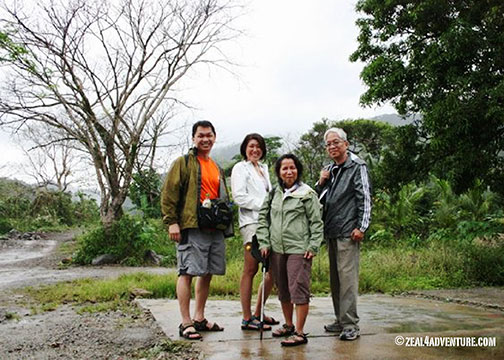
So before I start writing about my next destination, which took place last month in an icy setting and is the exact opposite of what we will be experiencing in the coming days, I’d like to take you to a place in Nueva Ecija. A little gem, they say it is. It was a spur of the moment and as these things go, we all made it.  Sometimes to plan is vain.

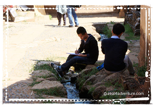
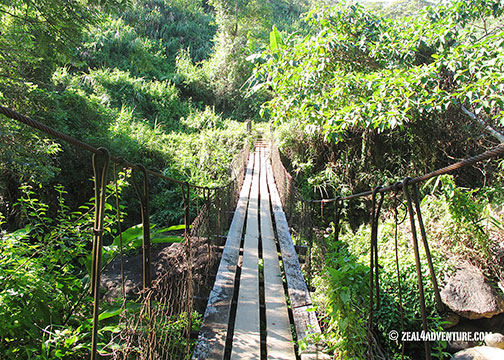
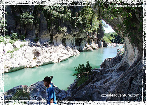
The small part of an otherwise well-paved road was only wide enough for our Explorer to safely get its way past the stream, thanks to this boy who helped us navigate our way.

Thanking him after, he offered to be our guide. Enterprising young man. And so for 500Php, the then 14-year-old AJ took us around his playground.

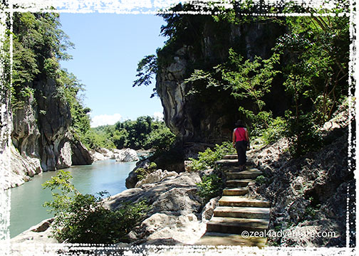
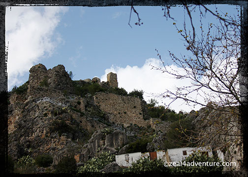
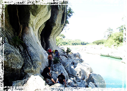
We navigated the short but somehow challenging, sometimes slippery rocks and trail to the cave that AJ said would take only 5 minutes. “Akala ko 5 minutes lang sa loob ng cave, bakit parang 20 minutes na kami ditto sa loob ah?” (I thought it only takes 5 minutes to explore the cave, why does it seem like 20 minutes already?) I asked AJ. “Kasi ang bibilis nyo mag lakad!” “Because you all walk so fast!” he said. He has a point.  🙂

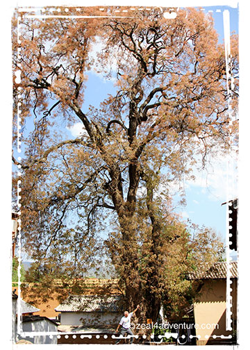
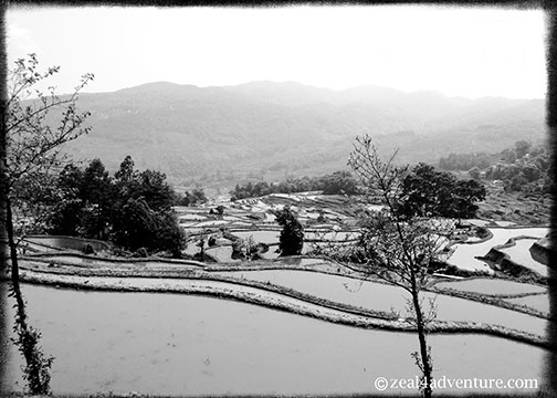
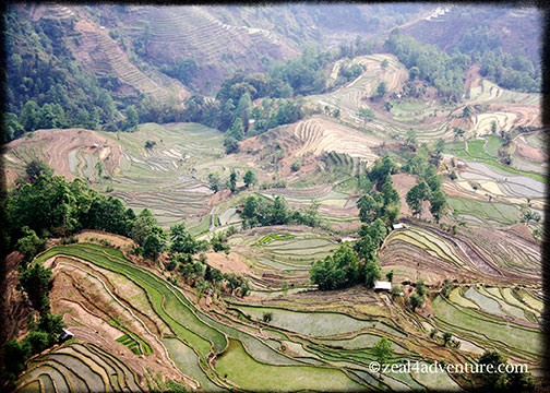
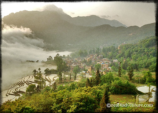
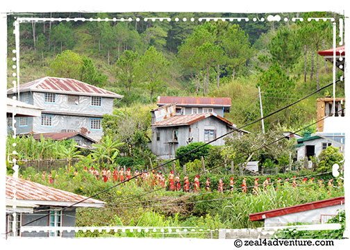
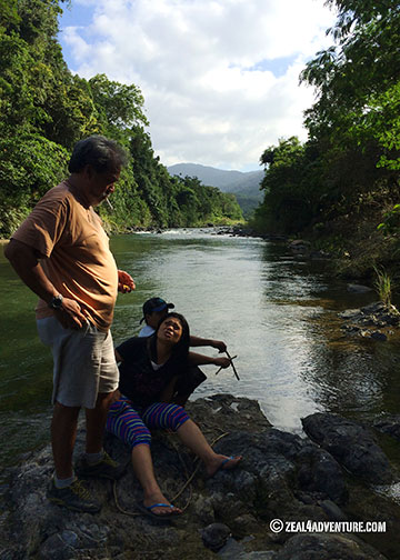
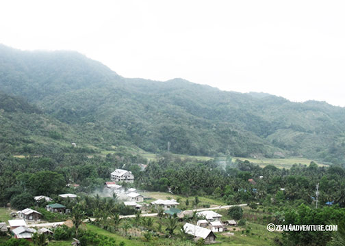
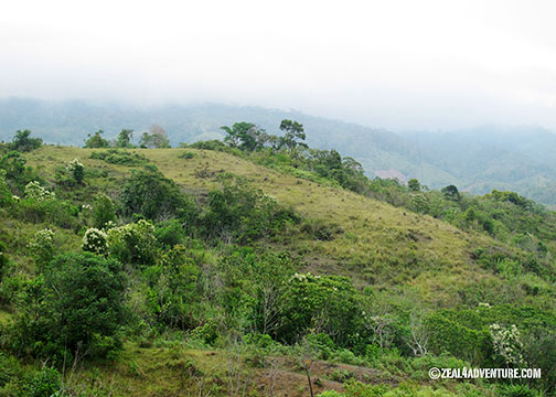
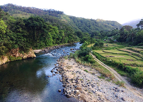
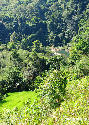
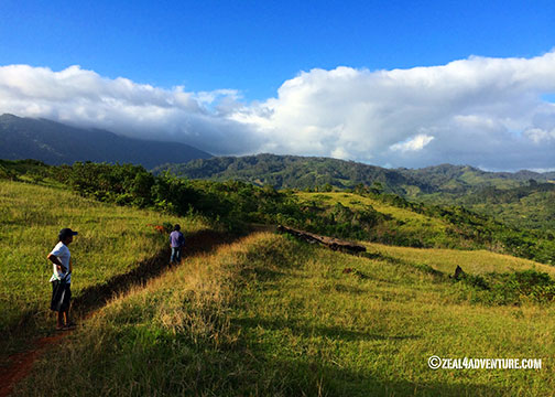
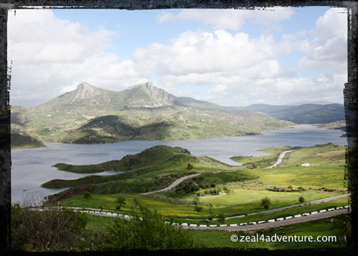
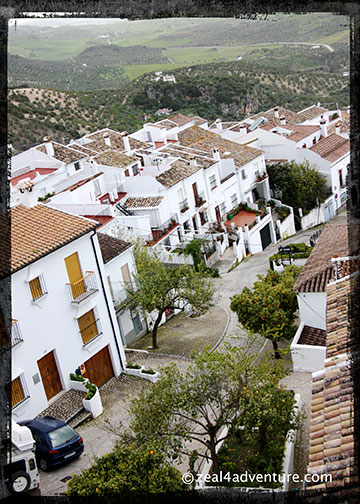
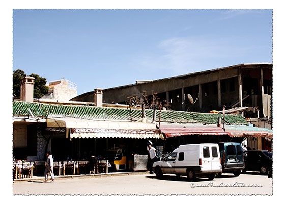
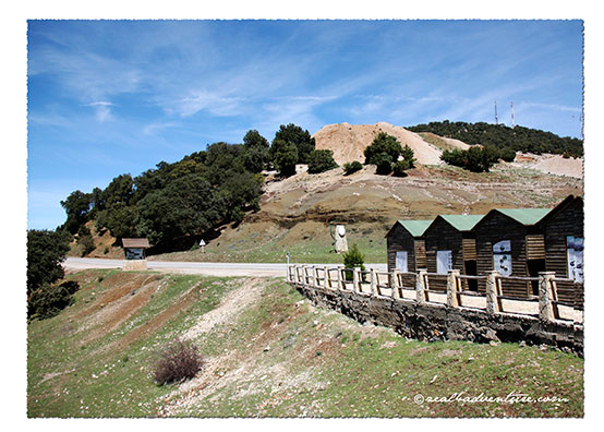
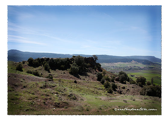
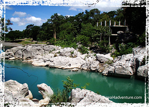
In the foothills of the Sierra Madre lies a protected area in the municipality of General Tinio (sometimes also called Papaya – don’t ask me why) where the Penaranda River flows cutting through magnificent limestone walls.

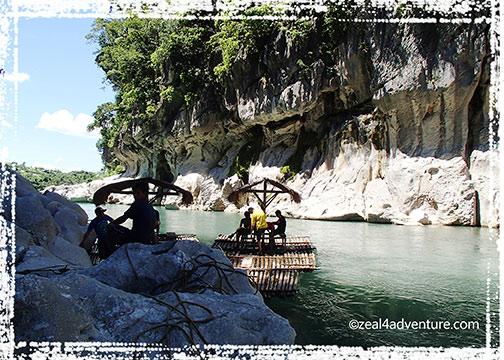
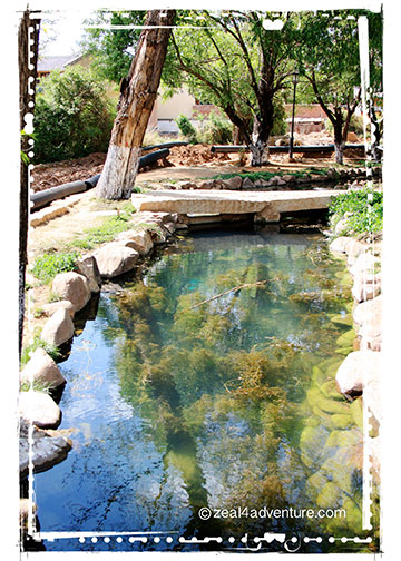
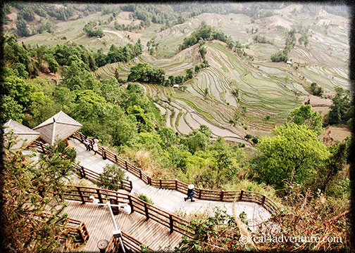
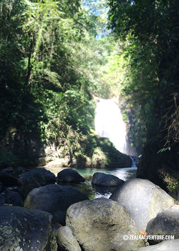
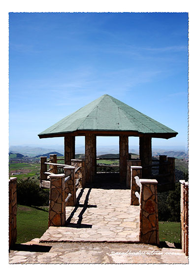
One can trek to the caves through the limestone wall, swim in the crystal clear, refreshing water or simply soak in the scenery while enjoying a packed lunch on the raft.

Do try to make your way there if you haven’t. An enjoyable day trip it certainly was.

Advertisement

Shaxi: Quaintest of Quaint

This must be the quaintest of quaint towns I’ve set foot on in quite a while if not in all of my travels. Found halfway between Dali and Lijiang,

sideng-square-from-trail-cafe

Shaxi is home to beautifully preserved adobe courtyard mansions that offer a glimpse into a forgotten era. It was the most intact trading center for centuries linking Yunnan into Bhutan and Tibet on the Tea and Horse Caravan Trail and this lead to its prosperity during the Tang Dynasty. The network channeled tea, horse, and other valuables among the diverse ethnic groups residing in the eastern Himalayan region. What lead to the trail’s demise was the development of the road transportation and Shaxi became just another village in the 1950s. In 2001, the village was included in the protection list of 101 endangered sites and a Swiss-led team worked for years to restore the deteriorating town.

alleyway

The old town of Shaxi is quite compact and easily explored by foot.

sideng-square

It consists mainly of a few quiet lanes and alleys that radiate from Sideng Square—a fascinating marketplace at the heart of Shaxi where we spent most of that Sunday people watching and just chilling.

chilling

The iconic Sideng Theater seats in the middle of the square.

sideng-theater

The unique 4-storey architectural structure and exquisite craftsmanship are the soul of Shaxi because it is (to this day) where the Bai people perform during celebrations.

Across the theater is the Xingjiao Temple. Both are ancient structures that add character to the square. The temple (now a museum) is one of the best-preserved temples in the entire China because it was sequestered and used as a local government headquarters during the Cultural Revolution.

xingjiao-temple-interior

This ironically saved it from destruction. Coupled with painstaking restoration by the Shaxi Rehabilitation Project (SRP), a visit is worth the while. Original murals can still be seen on the walls of the Hall of the Heavenly King.

hei-hui-river

One alleyway leads to the eastern village gate and outside this gate, the Heihui River meanders from north to south through Shaxi.

yujin-bridge-2

The crescent-shaped Yujin Bridge was the only way for the Bai people go to the fields and do business back in the days. With the towering mountains as a backdrop, this bridge is a sight to behold and is one of the highlights of this leg.

simple-joys

Many find pleasure just to simply lie on the grass and chill.

guesthouse-cafes-and-stores

What used to be tack shops, blacksmiths and caravanserais are now guesthouses and

western-dishes

western-dishes-2

foreigner-friendly cafes (offering English menus and western style dishes), which signals an upcoming tourism boom (read: tourist buses) in this old town.

daytrippers-2

Though its visitors still form a fascinating merge of intrepid and curious travellers, many of its visitors (at the time of my visit) came in groups and spent an hour or so running through the ancient streets taking shots of the temple and theatre.  This tells me that the boom might have started already.

daytrippers

The best time to enjoy the quietness of this old trade post is first thing in the morning or very late at night.

square-at-night

As soon as the last bus headed back to Lijiang, the sanctuary of calm kicks off and we sit in the square savoring the solitude.

night-life

At night, we shared the square with the art students. We sit sipping our cup of coffee while they gather around the plaza playing street games under the moonlight and a few lights illuminating the square.

Scenes of Shaxiearly-morning-in-sideng-square

Sideng Square the day after, during breakfast, before journeying on to Lijiang.
ancient-treeAncient tree scatter around the village.
art-students-on-a-field-tripArt students abound; finding inspiration in this breathtaking old town.
 resort-on-the-riseA resort on the rise.
crystal-clear-waterA crystal clear stream flows through the main street of the ancient village.

resident

funny-english-translationsBastardized English Menu
fried-parametersThe fried parameters look like worms but is a root (perhaps from the ginseng family)
park-by-the-riverThe park by the river, just outside the East gate of the ancient town.
guesthouse-courtyardThe courtyard of our guesthouse (Renjia just off the village entrance) — turned into a drying area.
guesthouse-entranceThe entrance to our guesthouse was through the kitchen.
meal-at-renjiaPerhaps why they serve delicious Yunnan cuisine at our guesthouse.  This was lunch when we arrived.
modern-day-give-awayModern day giveaway — local kids with they games.

knitting

locals

little-girl

A Piece of Heaven

Magical, massive, magnificent—endless terraces in a sea of clouds is a sight to behold. Not foreign to rice terraces, I found myself awed by the vastness and intricacy of the Yuanyang terraces, now the 45th World Heritage Site in China. Breathtaking after breathtaking scenes came before us as we drew closer to the center.

terraces-by-the-road-2

Regarded as the core of the Hani Terraces, where its ancestors settled 2,500 years ago.

hani-people

In its steep mountains and challenging terrain, the Hani people struggled and succeeded in growing rice. Their creativity turned this mountain into one artistic beauty that has placed Yuanyang on the map for impressive rice paddy terracing.

duoyishu-terracesDuoyishu Rice Terraces

With an area of 28,000 acres, it is similar to the Banaue terraces of my country but on a grander scale.

laohuzui-waiting-for-sunset

Three major scenic spots is a must. Scattered in different places, the terraces exhibit different tones and hues depending on the season and time of day. When we were there (in April), the terraces, still filled with water, glows from the sun’s ray.

laohuzui-sunsetLaohuzui Rice Terraces

So different from the one I am familiar with. It is stunning.

Laohuzui. The biggest Hani rice terraces listed in the World Cultural Heritage Site and ideal for sunset shots.

laohuzui-different-view-deck

It has 2 viewing areas, the higher deck closer to the road and a lower one closer to the terraces. Both views are lovely depending on how you want to capture its grandiosity.

laohizui-sunset-2

Bada. It has one of the biggest collections of terraces, and any angle is snap-worthy.

bada-terraces

From top to bottom, the terraces is said to be 3,900 steps.

Duoyishu. Surrounded by mountains on 3 sides and a valley on the east, it makes for a beautiful sunrise scene.

duoyishu-sunrise

The terraces, still filled with water, unveils the reflection of the soft golden sky just coming to light underneath a sea of clouds.

duoyishu-viewing-deck

From our beautiful guesthouse, Flower Residence, it was just t a 20-minute walk to the viewing deck.

pugao-village

And speaking or our guesthouse, we stayed in a charming boutique hotel in a village called Pugao Laozhai.

flower-residence

flower-residence-2

flower-residenceview-from-our-room

flower-residence-meals

Large glass windows to enjoy the fantastic view, wood everywhere, good food, combined with wonderful hosts CC and his uncle (who cooked fabulous meals)

with-hosts-cc

—is a formula sure to impress me, no doubt. A place where one can be happy to just hang out, I wish I had booked more than just a night.

Yuanyang is 2 more hours south from Jianshiu and definitely worth the road trip. A little piece of heaven with spectacular rice terraces so grand it almost guarantees poster-worthy shots at any angle.

duoyishu-terraces-upclose

terraces-by-the-road

laohuzui-changing-season

photograhers-haven-at-laohuzui

Begnas: A Ritual for Good Harvest

Happy and contented with finally being able to see up close the Panag-apoy, witnessing another festival is, what I would like to think of as, a bonus.

a-few-days-ago-2Walking to town from Ex-Mayor Killip’s house, which we rented for our stay, we saw these men in traditional Igorot clothes.

Former Sagada Mayor Tom Killip invited us to watch their ritual for a good harvest if we have time before heading down. Of course, we have time, we will make time.

dancing-2

Deeply rooted in culture and tradition, the Kankanaey community of Sagada celebrate a Rice Thanksgiving ritual that follows the cultural calendar of the Igorot. The dates of the Begnas are usually decided by the tribal leaders via age-old omen and signs and, therefore, have no fixed dates.elder

It is generally held to mark the different agricultural cycle—pre- planting or land preparation, planting and harvest—and apparently happens three times a year, loosely in March, June and November.

We were advised to be there early so not to disturb their celebration. Being early has its advantages.vantage-point

From our vantage point, we were able to watch the celebration up close without being in the way.gathering-in-the-dapay

Arriving in traditional clothes, men and women from different barangays gather in the hosting dap-ay.to-the-patpatayan

It starts with a group of men in a single file going off to the rice fields to sacrifice a pig on sacred ground the community calls patpatayan.practicing

Meanwhile, the men left in the dap-ay started to perform their traditional dances, not to entertain us (but perhaps themselves) but that we were.   After a half an hour perhaps, they came back, still in single file, to the dap-ay with the pig divided into pieces. The ceremony ends with everyone participating in the dance and the pieces distributed to each community.

dancing-3

pig-distribution

I am honored to have seen this tradition and was well worth setting our trip back for a few hours.

I leave you with more photos of the celebration:

a-few-days-ago

dancing-4

dancing

My New Paradise

AdamsCredits: JSprague Digi in Deeper course material.

Adams.  A familiar name yet peculiar for the Ilocos Norte, yes?  With names like Laoag, Pagudpud, Paoay… Adams sounds off.  The first time I heard of Adams was 16 years ago when Anton explored the river with fellow guides. He raved not only about the river but its natural surroundings as well.at-the-river

He went back several times to raft and to kayak the Bulo River but never with me. In 2009 on an Ilocos Road Trip, we attempted a visit to Adams to hike to the waterfalls. It rained, and we chickened out.  We never made it to the town.

2009-AdamsThis was at the junction where we’d take a habal-habal (motorcycle for hire) to take us to town.

view-of-the-townSprawling over a land area of 159.31 square kilometers on the northern coast of Ilocos Norte,

floraAdams is a treasure trove of rainforests with rare flora and fauna, centuries old trees,

hanging-bridgehanging bridges and waterfalls.

anuplig-fallsAnuplig Falls
cultural-danceWe were treated to a cultural show.

It is a small town of only one village but is a melting pot of ethnic groups composed of the Yapayao or Itneg, Ilocano, Igorot, Kankan-ay and Ibaloi, which explains why their cuisine is different from the Ilocano dishes we know.

local-produceWe had fried frog, udang (river shrimps), stir-fried pako, and mountain rice.

It is a hodgepodge of the various ethnic groups and what is locally available like gabi (Taro), crab lets, baby damo (wild boar), frogs, Udang (river shrimps), purple mountain rice, and my favorite, stir-fried pako (fiddlehead fern).

baguio-climateLike its name, it is a divergent from the rest of the region.  The climate is pleasantly cool especially at this time of the year, with temperatures just a few notched higher than Baguio.

I wish I had made more effort to visit this mountain-river town. It took me fifteen years to finally set foot here. My first trip to Adams was last year around this time. Ask me how many times I’ve been back since. Four so far. I have fallen in love with the area. Expect more posts from me. Meanwhile, here are some photos to whet your appetite for the place.  This is my new paradise.

bulu-riverThe Bulo River from a bridge.
enroute-to-anupligLush forest en route to Anuplig falls.
entertainmentHospitality to the hilt.  Entertainment provided by the villagers.
Ilyn's-HomeystayIlyn’s Homeystay: our home in Adams.
lover's-peak-2A beautiful point called “Lover’s Peak”
lover's-peakLovely grounds at Lover’s Peak.

Going Back in Time

Unless it is really impressive, I rarely write about accommodations on this blog. But this beach resort has definitely impressed. It’s a destination of its own, a place to pause and recharge, do nothing and pretend that you’re from an era of yesteryear.

antique-furnitures

In Victoria Village in Currimao, on an 18,000 square meter land facing the South China Sea sits an amazing recreation of a typical mid-20th-century village. little-detailsUndeniably a work of love by owner Dr. Joven Cuanang, a Medical Director of St. Luke’s Hospital, his love for the arts greatly manifested in this stunning village he calls Sitio Remedios.

salvaged-doors-and-windowsIts main attraction is the rows of vintage-style Ilocano houses made of salvaged bricks and woods from mid-century houses (about to be demolished) to resemble old ancestral houses. Most of them were named after the town of Ilocos Norte such as Batac, Dingras, Piddig, Bacarra and San Nicolas.

balay-dingrasThe bungalow assigned to us, Balay Dingras, has 2 rooms, dining-area-dingrasa living and dining area, and a spacious front porch that leads out to the plaza.balcony-to-plaza Furnished with antique furniture, a daybed even in the sala, decor are vintage and to complete the look, crocheted tablecloths, vintage-motif-bedInabel (a local weave) woven bedding, and blankets were used. Each room has a Queen sized bed and its own bath.

welcomeA welcome message on our bed – a nice touch.

Dingras and all the other balays (house) face the square they call Plaza Manzanilla. housesLaid out in a grid typical of Spanish times, fencing off each house are manzanilla (hence the name), Bougainvillea, and gumamela bushes and few ancient trees adding character to the square.  chapel-and-plazachapel-interiorA chapel that opens out to the plaza, a pool facing the sea and a dining hall that serves exceptional home-cooked Ilocano favourites completes this village.dining-hall

Tucked quite away from the main highway, all our dinners were had at the resort. Turned out to be the best decision we’ve made. Meals were simple yet superb and very well prepared.  foodThe dishes were served buffet style and depending on what’s available in the market.  dinner-by-the-poolDinner venues change every night, one night in the main dining hall, another near the pool area and our last night was a romantic setting at the plaza. candlelit-dinner-settingHow can you not feel special and totally recharged with such detailed service?

Currimao is in the southwestern part of Ilocos Norte, near the northern border town of Paoay. An hour away from Vigan, and only 25 minutes away from Laoag, Sitio Remedios is an ideal base to those who prefer to explore the Ilocos Region leisurely.

Useful Info:

Sitio Remedios: Barangay Victoria, Currimao, Ilocos Norte.  Tel (63)917-3320217

Andalusia’s White Town Jaunts

Ruta-de-pueblos-blancos

Between the provinces of Malaga and Cadiz, lodged between the valleys and mountains or clustered high on the hillsides within the Sierra de Grazalema Natural Park, lies a cornucopia of sleepy white towns and villages.  Traditionally lime-washed but now painted white houses make up these towns.  Known as the Pueblos Blancos, they create a striking contrast amid a backdrop of rugged limestone mountain.

Out of the 6 or 7 noteworthy villages on the Ruta de los Pueblos Blancos, we managed 3 on a rented Opel.

our-route

After breakfast, from Ronda we headed north via the A428 and found our way to the first village on our route, Setenil de los Bodegas.

Senetil-white-houses

This quaint little village has houses built into rock overhangs above the Rio Trejo, many of which have the rock as its natural roofs and walls.

Setenil structures-built-on-caves

Fetching in an unusual kind of way, this Setenil.

Setenil-narrow-hilly-roads-2

Looking for a place to have a few beers and tapas (as it was nearing lunch time), we discovered that the hilly, winding streets in some parts of town are intimidatingly narrow

Setenil-narrow-hilly-roads

especially if one’s stick shift skills are rusty and the car is rented.

Setenil rocks-make-natural-roof

On Plaza de Andalucia, we found Bar Restaurante Dominguez quietly tucked in a corner of Calle Herreria.

Setenil Restaurante-Dominguez

I don’t remember anymore what drew us there (hunger perhaps) but following the recommendation of the owner, lunch was truly satisfying.

Let me first tell you about this stunning natural park, Sierra de Grazalema.  It was declared a UNESCO Biosphere Reserve in 1977 because it has an exceptional variety of flora and fauna.

Grazalema-limestone-mountain-rangesDo you see the eagle perched on the craggy edge of the limestone?

A karstic region set in 51,695 hectares of land that is surrounded by a string of limestone mountain ranges known collectively as… Sierra de Grazalema.  So imagine the spectacular vista of rugged limestone cliffs, and impressive gorges, magnificent forest of rare Spanish firs, and the attractive white towns dotted around the sierra.

Grazalema-from-the-road

The village of Grazalema is located right at the center of its foothills.  A beautiful white town beneath the craggy peak of San Cristobal.

Grazalema-Plaza-Espana

It has its own charm with a simple central square, the Plaza de España, and cobbled streets lined with whitewashed houses with wrought ironed railing covered windows.

Grazalema-Iglesia-de-la-Encarnacion-from-afar

The town has two beautiful churches, Iglesia de la Aurora on Plaza de España and Iglesia de la Encarnacion.  It is an ideal base for those who want to hike the sierra.

The last village we managed was the most picturesque among the three and a real must.

Zahara overlooking the lake

At the northern end of the Grazalema Natural Park, this pueblos blanco overlooks the turquoise water of El Embalse, a huge reservoir that dominates the view from the village perched atop a hill.

Zahara-castle-remains

Zahara de la Sierra, once an important Moorish town has the surviving tower of the 12th century Moorish Castle looming over the valley.

Zahara-town-beneath

Scattered below on the slopes are the red-tiled roof whitewashed houses of the village.

This couldn’t be a more outstanding finale to this excursion.  Although we barely scratched the surface, like Ronda, visiting these pueblos blancos gave us a taste of the real Spain, its laid back way of life.

real-spain

Amid such splendor, how can you not stop and smell the flowers?  Cherish its beauty?  Why would you even want to go anywhere?

Useful Info:

Bar Restaurante Dominguez
Plaza de Anadlucia, 11
Setenil de las Bodegas, Cadiz
Contact: +34 956 13 45 31

The Road to Marrakech

hotel-swiss-chalet-style

Lakes, fountains, wide roads, Swiss-style villas, and green spaces… it’s like driving into a resort town in Switzerland.  But no, we’re still in Morocco, en route to Marrakech.

big-roads-ifrane

king-of-moroccoA photo of Morocco’s King Mohammed VI, a regular sight all around the country.

We took a pit stop in the city of Ifrane in the Middle Atlas, 50 kilometers south of Fes.  Built by the French in the 1930s as a resort town and an oasis in a desert,

the-plaza

a refreshing break from the cramped, dusty alleyways of the medina.

Dayet-Aoua-2

Sitting in a natural depression, Lake Dayet Aoua, is a relatively well-conserved lake within the Parc National d’Ifrane.

Dayet-Aoua

Rich in bird life and woodlands, it is a popular destination of birdwatchers.

The most amazing roast chicken we had on our entire Moroccan adventure was at a roadside restaurant our driver took us to.

roadside-eatery

roasting-chicken

Juicy, succulent with a touch of Moroccan flavors…

roast-chicken

and just thinking of it had me craving for it now.

tagineCarrots, potatoes with beef slow cooked in Moroccan spices.

The vegetable and beef tagine we had with the chicken.

exhibitview-deckview-from-view-deckWe stopped by an exhibit of the Ifrane National Park by the road side.

The trip took 10 hours, 2 hours over the estimated time because, aside from making several stops along the way, the driver took speed limit very seriously.

scenery

This is a typical road scene before I dozed off and woke up in Marrakech at half past eight in the evening, our driver trying to find the Sidi Ben Youssef Mosque, where we are to meet our next host, Adam.

An Outing Outside of Fes: Meknes

An article I read about the vineyards in Muslim populated Morocco got me interested in Meknes. Despite its religious stricture on consumption, thanks to its gentle climate, generous sun, and rich soil, the Meknes region is home to many vineyards and olive groves. I considered a vineyard tour but, to be honest, I completely abandoned the whole wine tasting idea at the last minute in lieu of the very impressive Volubilis. And because walking around the ruins of the Roman settlement took just a little over an hour, we had more time to visit the city of Meknes.

View-of-the-old-city

Much less visited than its neighbor Fes, the most unpretentious of imperial cities—Rabat, Fes, Marrakesh being the other three— as it was developed as a capital late in the history of Morocco and only briefly, by a single sultan, Moulay Ismail. Meknes, despite its humble past, rewards travelers with beautiful gates, ramparts, mosques, and palaces and is often referred to the Versailles of Morocco.  As one of the imperial capital, Sultan Moulay Ismail built the city’s vast imperial palaces and massive walls to rival King Louis XIV’s Versailles hence the reference. Suffice to say, his tomb rests here. The weather turned cold and wet, which prevented us from wandering around much, we nevertheless managed to visit a few sites.  We would have loved to see the inside of Ismail’s granary (Heri es Souani), but it was close on a Sunday.

Place el Hedime

Place-el-Hedim

At the heart of Meknes linking the medina and the Kasbah, the large square is lively in the afternoon,

a-glimpse-of-chaosA glimpse of chaotic Djemaa el Fna

much like but a lot tamer than the Djemaa el Fna of Marrakech (you will know what I mean on my future post).  The outstanding architectural detail of the walls and gates (especially of Bab Mansour) makes for a more compelling square than Place Seffarine and Boujloud.

Moulay Ismail’s Mausoleum

triple-arch-of-mausoleum

From the main entrance, an archway leads to a triple-arched entrance.  A small yellow room with a small fountain in the middle greets as you enter the mausoleum.

Moulay-Ismail-Mausoleum

This leads to the first of several open aired courtyard surrounded in all sides by bright yellow walls.  The last courtyard fronts sanctuary where the tomb is.  While non-Muslims are not allowed inside the sanctuary, it was possible to have a glimpse of the tomb from the antechamber.

Sahrij Souani Bassin

Sarij-Swani-lake

It was said that the lake, measuring 319m by 149m, was constructed to ensure the supply of water to the town in case of drought or siege.  The reservoir is connected to the water system of the city, which was considered an ancient engineering wonder.

sahrij-Swani-wall

This is the exterior of Heri es Souani, the ingeniously designed stables of Moulay Ismail.  To keep the temperature cool and air circulating, the structure was built with tiny windows, massive vaults and an underground water channel system.  The gigantic storerooms provide stabling and grains for 12,000 horses.  Too bad we were there at the wrong time and couldn’t see the inside, they say it is bewildering.

An Outing Outside of Fes: Moulay Idriss

Moulay-IdrissCredits: Digital sketch by Jen Caputo (http://jencaputo.typepad.com); Papers from Scrapmatters’ Life’s Little Surprises kit — Happy Scrappy Girl, Graham like the Cracker, Haynay Designs

Seated comfortably in the van, enjoying the company of family and newfound friends,

Lake-ChahandLake Chahand

we marveled at the beauty along the way,

roadside-vendor

even stopping to buy some oranges and dried figs from a roadside vendor.

An hour away from Fes is a picturesque whitewashed town scenically perched in the foothills of the Rif Mountain.

donkeys-and-cars

whitewashed

Moulay Idriss is the first of several destinations planned for the day. Considered the holiest town in Morocco, we paid a visit to the final resting place of the town’s namesake, Morocco’s religious and secular founder and the great-grandson of the prophet Mohamed.

entering-the-mausoleum

His shrine is actually off-limits to non-Muslims, but we were able to go as far as the first courtyard.

first-courtyard

Until 2005, non-Muslims were not permitted to spend the night in town and tourists were advised to be out of town by 3pm. Today, I noticed a few lodgings while walking around.

off-limits-beyond-this-pointThis is where we end the visit to the shrine.  Off limits from here.

The town is considered to be the holiest in Morocco.  They say that, for Moroccans who can’t afford the trip to Mecca, five pilgrimages to Moulay Idriss is equal to one to Mecca.

end-of-town

picturesque-view

Pretty and peaceful with beautiful views across the foothills,

local-market

dried-figs

the village has a charming little souk with stalls selling everything from fruits to live hens.

main-square

And while we were not allowed inside the mosque and shrine, we had fun walking around the main square. It is a great place to people watch while sipping mint tea

kebab

or enjoy a terrific lunch of grilled meats before or after a visit to Volubilis.

Aside from the fact that our driver barely spoke English, Ibrahim confessed to never having explored the town of Moulay Idriss and the nearby city of Volubilis making it the perfect reason to come along.

the-groupNew-found friends flanked: Israeli couple Ronin and wife and Ibrahim

But I think he just really likes us.