Minalungao

It’s the first days of summer, and this draft has been on the back burner giving way to other bigger trips I’ve had.

So before I start writing about my next destination, which took place last month in an icy setting and is the exact opposite of what we will be experiencing in the coming days, I’d like to take you to a place in Nueva Ecija. A little gem, they say it is. It was a spur of the moment and as these things go, we all made it.  Sometimes to plan is vain.

The small part of an otherwise well-paved road was only wide enough for our Explorer to safely get its way past the stream, thanks to this boy who helped us navigate our way.

Thanking him after, he offered to be our guide. Enterprising young man. And so for 500Php, the then 14-year-old AJ took us around his playground.

We navigated the short but somehow challenging, sometimes slippery rocks and trail to the cave that AJ said would take only 5 minutes. “Akala ko 5 minutes lang sa loob ng cave, bakit parang 20 minutes na kami ditto sa loob ah?” (I thought it only takes 5 minutes to explore the cave, why does it seem like 20 minutes already?) I asked AJ. “Kasi ang bibilis nyo mag lakad!” “Because you all walk so fast!” he said. He has a point.  🙂

In the foothills of the Sierra Madre lies a protected area in the municipality of General Tinio (sometimes also called Papaya – don’t ask me why) where the Penaranda River flows cutting through magnificent limestone walls.

One can trek to the caves through the limestone wall, swim in the crystal clear, refreshing water or simply soak in the scenery while enjoying a packed lunch on the raft.

Do try to make your way there if you haven’t. An enjoyable day trip it certainly was.

Advertisement

Responsible Traveling

Sagada's-RealityCredits: Papers by Splendid Fin 4ever Swirls and Now is paper in green; The Design Girl paper 1; Elements from Scrap Matter’s Life Little Surprises: leaf and flower by Scrapmuss; frame by Gwenipooh Designs; Splendid Fin Now is Striped ribbon

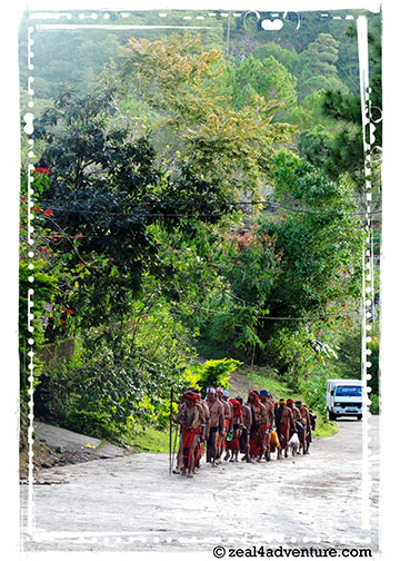
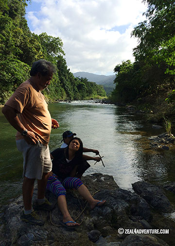
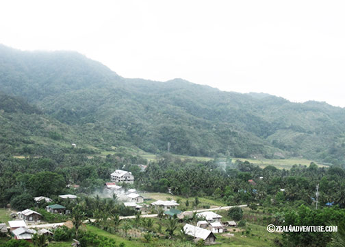
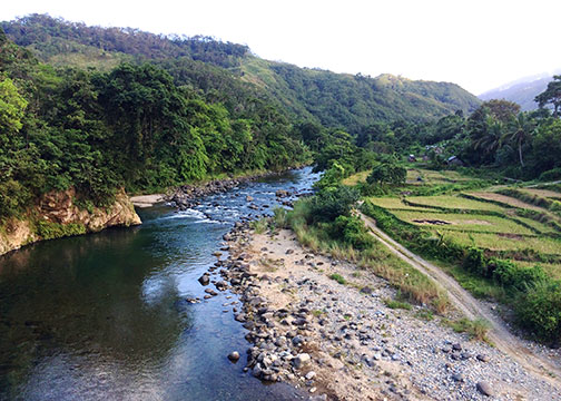
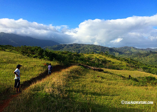
My first entry to Sagada was in 1994. I was instantly drawn to it because it reminded me of a TV series set in Alaska that I love. Remember Northern Exposure? Rustic town, log cabins, lots of trees, hilly and winding roads, cool weather, sunflowers, indigenous people… well, it doesn’t snow in Sagada, but you get the drift. But more than that, it had caves, waterfalls, rice terraces, lakes and green pastures too. It has become my haven of rest, my respite when the going gets tough in the metro. I’d frequent it through the years.

St-Mary's
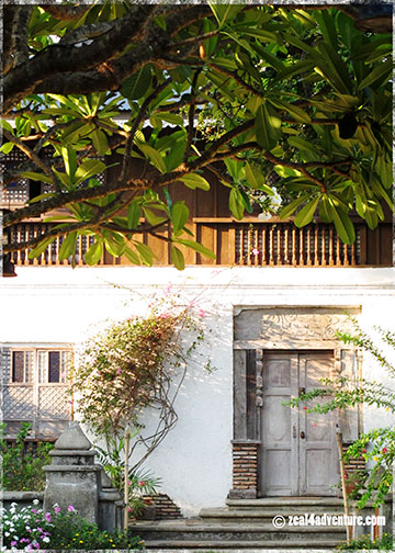
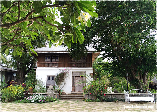
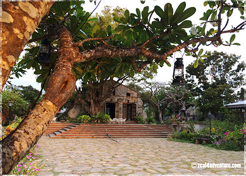
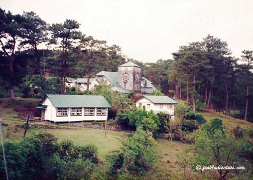
Unobstructed view of St. Mary’s Episcopalian Church back then.  1997.

Back in the days when going to Sagada entails eight to ten hours of (no air conditioning) bus ride and two very bumpy, dusty jeepney rides because you dare not subject your car to the condition of the road (fit for a 4×4 only) leading up to Sagada. Inaccessibility kept Sagada away from the crowd. You had to adore the place to keep going back or even attempt a visit back then.

Walking-to-Lake-Danum
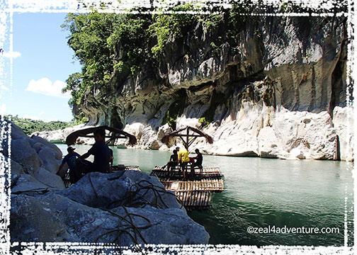
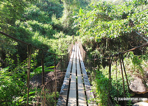
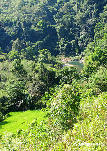
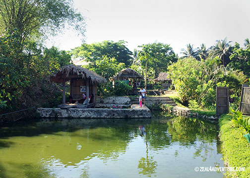
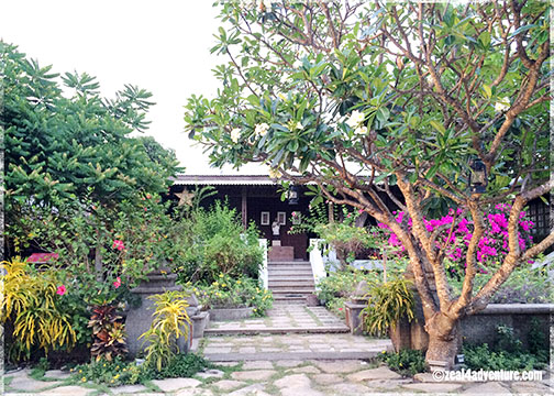
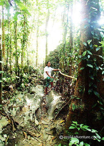
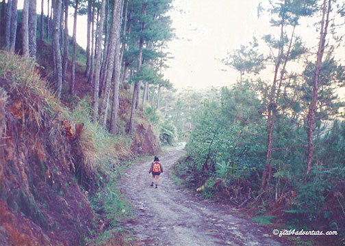
Walking to Lake Danum.  1997.

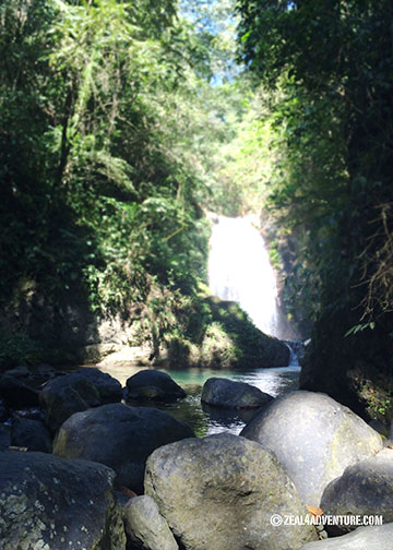
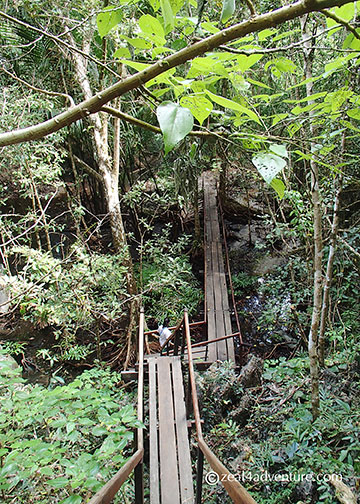
Back in those days, we’d walk everywhere. Sumaging Cave, Lake Danum, Kiltepan, Echo Valley, except for Bomod-ok Falls, where we’d take a jeep to the jump off point to the village of Fedelisan. I remember my first attempt to the falls—muddy and slippery and scary.

narrow-path-to-the-falls
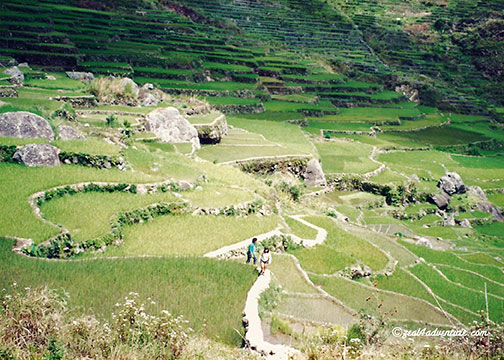
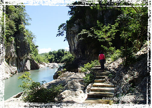
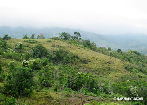
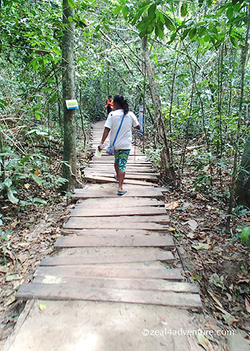
The terraces were narrower then unlike the wider cemented walkways of today (done for the tourists in mind).

Fedelisan-terraces
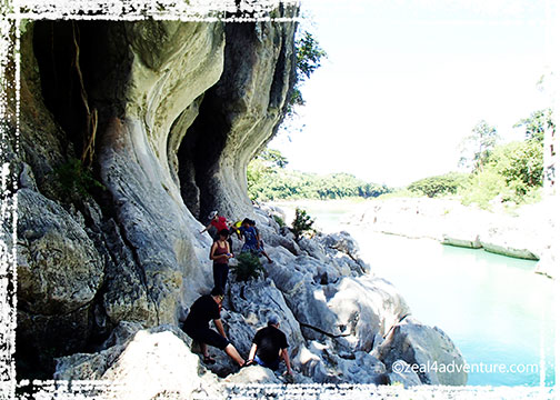
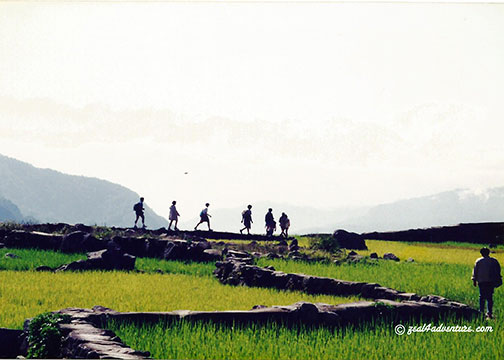
Some paths only had rocks to step on. That was scary.

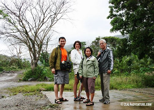
Back in those days, there was no way to book a room in advance. We’d take a chance and stay wherever there was room. We’d take cold showers because we didn’t know that they sell hot water by the pot for 10 pesos. Crazy, I know. But those were the best times.

The way to Sagada has gotten so much easier because the roads are paved now. Visitors tripled, probably quadrupled over the years. Accommodations of all sorts have sprouted, eateries too. Subtle changes I didn’t mind at all. I actually loved the new additions until my haven of rest started to morph from a tranquil, laid-back escape into a noisy, car-packed town. I now become nostalgic of what Sagada used to be and desiring the old one back.
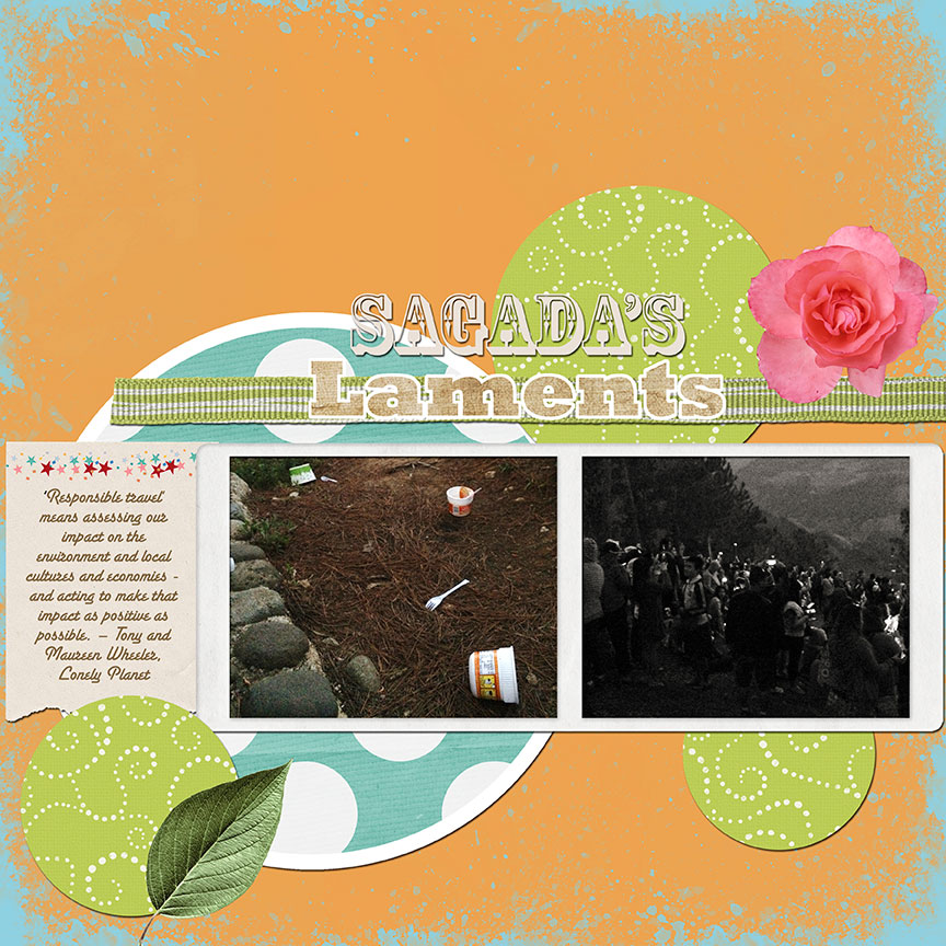
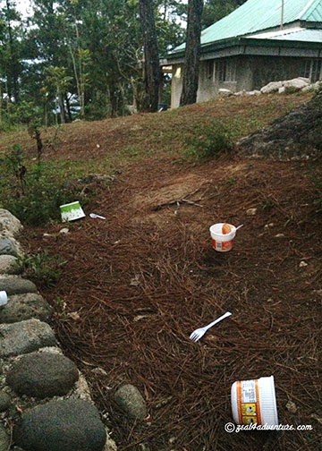
IMG_7145Basura and problema  naming ngayon (we now have a problem with trash),” says friend and guide Fabian. In the many years that travellers (mostly foreign and local backpackers) have come, trash had never been an issue until recently.

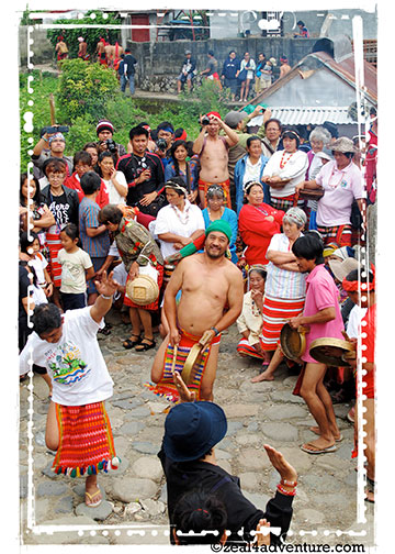
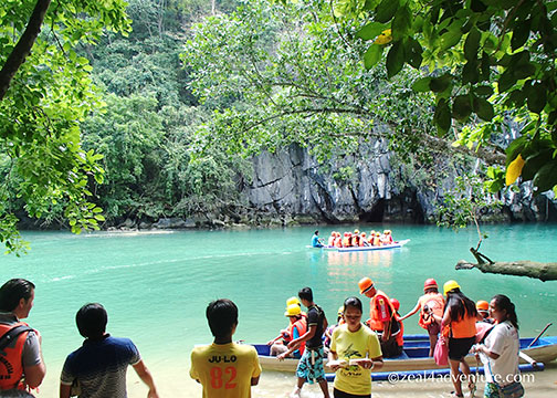
And that recently is when the Filipino hit flick, “That Thing Called Tadhana” unwittingly made Sagada an “in” thing.   Nothing wrong with that but sad to say, many of new visitors are irresponsible tourists leaving not only their footprints but also their trash behind.

IMG_7146

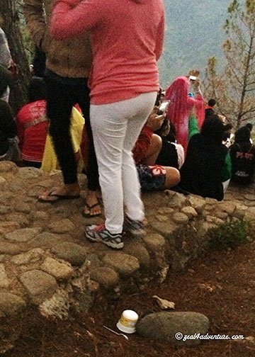
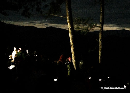
I have yet to understand their psyche but I sense a lack of respect for nature and the surroundings. While waiting for the sunrise in Kiltepan (which by the way was packed with perhaps 200 people taking “selfies”that morning),

crowd-in-Kiltepan

taking-selfies
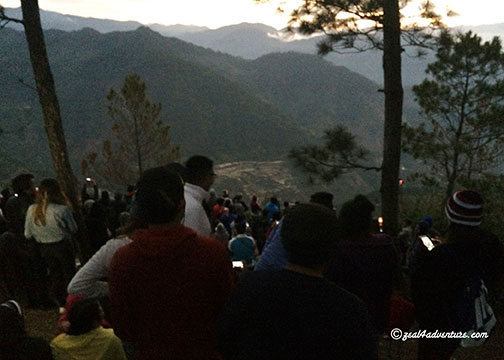
I’d hear words like “Bet ko nandito parin tayo ng 7 o’clock” (bet you we’re still here by 7 o’clock), like the sun will never rise.
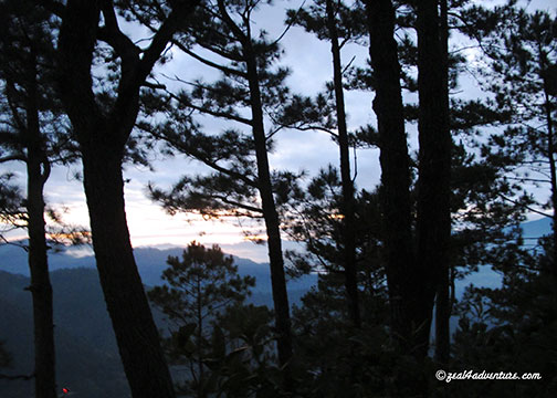
sunriseSana natulog nalang tayo” (we should have just slept in), one said before leaving because the sunrise wasn’t spectacular.   Folks, the sun will rise, that’s for sure but life does not promise dramatic ones every day.   I tell myself to chill because people think differently but how do you explain this one— “Pinaasa lang tayo ng sunrise” (in essence, it means – the sunrise led us on).   Really? Like nature owes you?

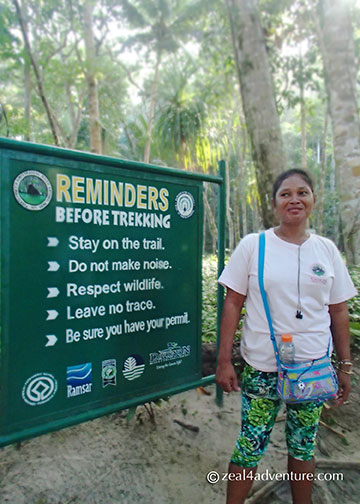
I always encourage people to travel because it is enriching. Depending of course on how one takes a trip, the experience can be priceless. But, we need to change our travel habits and be responsible travelers, to be responsible enough to properly dispose of our trash, respect local tradition and most especially their environment. I hope one day we learn to be just that.

‘Responsible travel’ means assessing our impact on the environment and local cultures and economies – and acting to make that impact as positive as possible. – Tony and Maureen Wheeler, Lonely Planet

Begnas: A Ritual for Good Harvest

Happy and contented with finally being able to see up close the Panag-apoy, witnessing another festival is, what I would like to think of as, a bonus.

a-few-days-ago-2Walking to town from Ex-Mayor Killip’s house, which we rented for our stay, we saw these men in traditional Igorot clothes.

Former Sagada Mayor Tom Killip invited us to watch their ritual for a good harvest if we have time before heading down. Of course, we have time, we will make time.

dancing-2

Deeply rooted in culture and tradition, the Kankanaey community of Sagada celebrate a Rice Thanksgiving ritual that follows the cultural calendar of the Igorot. The dates of the Begnas are usually decided by the tribal leaders via age-old omen and signs and, therefore, have no fixed dates.elder

It is generally held to mark the different agricultural cycle—pre- planting or land preparation, planting and harvest—and apparently happens three times a year, loosely in March, June and November.

We were advised to be there early so not to disturb their celebration. Being early has its advantages.vantage-point

From our vantage point, we were able to watch the celebration up close without being in the way.gathering-in-the-dapay

Arriving in traditional clothes, men and women from different barangays gather in the hosting dap-ay.to-the-patpatayan

It starts with a group of men in a single file going off to the rice fields to sacrifice a pig on sacred ground the community calls patpatayan.practicing

Meanwhile, the men left in the dap-ay started to perform their traditional dances, not to entertain us (but perhaps themselves) but that we were.   After a half an hour perhaps, they came back, still in single file, to the dap-ay with the pig divided into pieces. The ceremony ends with everyone participating in the dance and the pieces distributed to each community.

dancing-3

pig-distribution

I am honored to have seen this tradition and was well worth setting our trip back for a few hours.

I leave you with more photos of the celebration:

a-few-days-ago

dancing-4

dancing

My New Paradise

AdamsCredits: JSprague Digi in Deeper course material.

Adams.  A familiar name yet peculiar for the Ilocos Norte, yes?  With names like Laoag, Pagudpud, Paoay… Adams sounds off.  The first time I heard of Adams was 16 years ago when Anton explored the river with fellow guides. He raved not only about the river but its natural surroundings as well.at-the-river

He went back several times to raft and to kayak the Bulo River but never with me. In 2009 on an Ilocos Road Trip, we attempted a visit to Adams to hike to the waterfalls. It rained, and we chickened out.  We never made it to the town.

2009-AdamsThis was at the junction where we’d take a habal-habal (motorcycle for hire) to take us to town.

view-of-the-townSprawling over a land area of 159.31 square kilometers on the northern coast of Ilocos Norte,

floraAdams is a treasure trove of rainforests with rare flora and fauna, centuries old trees,

hanging-bridgehanging bridges and waterfalls.

anuplig-fallsAnuplig Falls
cultural-danceWe were treated to a cultural show.

It is a small town of only one village but is a melting pot of ethnic groups composed of the Yapayao or Itneg, Ilocano, Igorot, Kankan-ay and Ibaloi, which explains why their cuisine is different from the Ilocano dishes we know.

local-produceWe had fried frog, udang (river shrimps), stir-fried pako, and mountain rice.

It is a hodgepodge of the various ethnic groups and what is locally available like gabi (Taro), crab lets, baby damo (wild boar), frogs, Udang (river shrimps), purple mountain rice, and my favorite, stir-fried pako (fiddlehead fern).

baguio-climateLike its name, it is a divergent from the rest of the region.  The climate is pleasantly cool especially at this time of the year, with temperatures just a few notched higher than Baguio.

I wish I had made more effort to visit this mountain-river town. It took me fifteen years to finally set foot here. My first trip to Adams was last year around this time. Ask me how many times I’ve been back since. Four so far. I have fallen in love with the area. Expect more posts from me. Meanwhile, here are some photos to whet your appetite for the place.  This is my new paradise.

bulu-riverThe Bulo River from a bridge.
enroute-to-anupligLush forest en route to Anuplig falls.
entertainmentHospitality to the hilt.  Entertainment provided by the villagers.
Ilyn's-HomeystayIlyn’s Homeystay: our home in Adams.
lover's-peak-2A beautiful point called “Lover’s Peak”
lover's-peakLovely grounds at Lover’s Peak.

Going Back in Time

Unless it is really impressive, I rarely write about accommodations on this blog. But this beach resort has definitely impressed. It’s a destination of its own, a place to pause and recharge, do nothing and pretend that you’re from an era of yesteryear.

antique-furnitures

In Victoria Village in Currimao, on an 18,000 square meter land facing the South China Sea sits an amazing recreation of a typical mid-20th-century village. little-detailsUndeniably a work of love by owner Dr. Joven Cuanang, a Medical Director of St. Luke’s Hospital, his love for the arts greatly manifested in this stunning village he calls Sitio Remedios.

salvaged-doors-and-windowsIts main attraction is the rows of vintage-style Ilocano houses made of salvaged bricks and woods from mid-century houses (about to be demolished) to resemble old ancestral houses. Most of them were named after the town of Ilocos Norte such as Batac, Dingras, Piddig, Bacarra and San Nicolas.

balay-dingrasThe bungalow assigned to us, Balay Dingras, has 2 rooms, dining-area-dingrasa living and dining area, and a spacious front porch that leads out to the plaza.balcony-to-plaza Furnished with antique furniture, a daybed even in the sala, decor are vintage and to complete the look, crocheted tablecloths, vintage-motif-bedInabel (a local weave) woven bedding, and blankets were used. Each room has a Queen sized bed and its own bath.

welcomeA welcome message on our bed – a nice touch.

Dingras and all the other balays (house) face the square they call Plaza Manzanilla. housesLaid out in a grid typical of Spanish times, fencing off each house are manzanilla (hence the name), Bougainvillea, and gumamela bushes and few ancient trees adding character to the square.  chapel-and-plazachapel-interiorA chapel that opens out to the plaza, a pool facing the sea and a dining hall that serves exceptional home-cooked Ilocano favourites completes this village.dining-hall

Tucked quite away from the main highway, all our dinners were had at the resort. Turned out to be the best decision we’ve made. Meals were simple yet superb and very well prepared.  foodThe dishes were served buffet style and depending on what’s available in the market.  dinner-by-the-poolDinner venues change every night, one night in the main dining hall, another near the pool area and our last night was a romantic setting at the plaza. candlelit-dinner-settingHow can you not feel special and totally recharged with such detailed service?

Currimao is in the southwestern part of Ilocos Norte, near the northern border town of Paoay. An hour away from Vigan, and only 25 minutes away from Laoag, Sitio Remedios is an ideal base to those who prefer to explore the Ilocos Region leisurely.

Useful Info:

Sitio Remedios: Barangay Victoria, Currimao, Ilocos Norte.  Tel (63)917-3320217

The Trek to the Underground River

Underground-RiverCredits: Papers by Plum Dumpling Designs, Pri Rocha, The Design Girl, Trixie Scap Design; Ribbon by Design by Tater, Red string with flowers by Graham Like the Cracker, and String wrap by Haynay Designs. 

Elusive in the past, I became disinterested and eventually gave up the idea of visiting Palawan’s famous Underground River. Then they re-opened the Jungle Trail.

Initially slated for December but due to unforeseen reasons, we moved our Puerto Princesa trip to January.  We planned to simply chill out, visit our favorite jaunts and catch up with friends. Then, the grand idea— “why not go to Sabang for the day so you can finally see the Underground River?” Anton to me.  Me to him,  “Ok, but we will trek to the cave.”

Sabang-Pier

The Sabang Pier is the main jump off point to the Underground River or The Puerto Princesa Subterranean River National Park, once also called the St. Paul Subterranean River. Yes, it has many names. A UNESCO World Heritage Site since 1999, the cave was provisionally chosen (through votes—and you know how we Filipinos can vote) as one of the 7 New Wonders of Nature in 2011.

Entrance-from-the-shoreEntrance from the shore

The usual way to get there is to take a 15-20 minute boat ride (I estimate) from the pier.

There are two trails to the cave, The Monkey Trail, and the Jungle Trail. The former has been closed for a time now and the latter re-opened only last year. Having heard of the Monkey trail from friends who did it some 10 years back, I knew that I’d do it at some point. Well, the jungle trail, I reckon, is good enough.

crossingThe trek starts by crossing the mangrove.

A recommended option for the active, the jungle trail meanders through a beautiful lush forest.

dwarfed-by-trees

It lets you hike through ancient trees, well crafted wooden staircases, bridges and benches made from confiscated wood that adds character to the trail

wooden-walkways

one-among-many-bridges

and at one point, limestone formations becomes backdrop behind the foliage.

limestone-backdrop

Not only does the pleasant 2-hour hike enhance the experience but it also gives jobs to the 20 or so Tagbanua indigenous community members.

guide

reminder-before-the-trek

As “Park Wardens” they serve as guides and caretakers of the jungle.

path-to-the-riverthe path from the trail

The Underground River itself was not a let down at all. Having heard of so many mixed reviews, expectations were low.

paddle-boatsWaiting in line to enter the cave.

But to my surprise, the chambers especially the one called “the cathedral,” towering some 800 meters high, impressed me.

inside-the-cave

Truth to tell though, I fell asleep some part of the way, perhaps due to exhaustion and the fact that the only thing lighting the way was a flashlight held by the person in front. Our guide was adept and quite engaging in providing intelligent albeit elementary information about what a cave system is.

lush-forest-2

My take on this experience: to go there just for the Underground River may not be worth the effort (it’s still a 2-hour ride to Sabang). The hikes makes the difference.  Having seen Sabang, I wish I had stayed a few nights to explore the quiet town.

Rest of Batan: Mahatao

When I think of Mahatao, this simple church is the first thing that comes to mind – not the lighthouse,

Photo taken in 2006.

and certainly not the boat shelter,

An island detached from the main island provides shelter for inter-island vessels.

both constructed sometime around the mid-2000 only.  The church, however, has been a fixture in this old sleepy town since the days of yore and every time I am in Batanes, I get to visit it.

It is, after all, the biggest structure in Mahatao.

San Carlos Borromeo Church is one of the oldest existing church in Northern Luzon that still keep its centuries old features making it a National Cultural Heritage Treasure.

Also part of Mahatao is the Chanarian View Deck.

Another personal favorite, it has breathtaking views of Batan and the rugged cliffs.

Concrete stairs lead down the cliff if one cares to explore the water below.  I prefer the view from the road.

Last May while enjoying the view, I chatted with our guide Mang Rudy about life in Manila.  Life in the capital, as he describe it, is hard enough as a single, sometimes holding 2 jobs just to make ends meet.  When he got married, he knew that it would be difficult to raise a family if he stayed.  So they went back and now that they are settled and has called Batanes home once more, he is happy.  A guide before he left, he picked up where he left off citing that the influx of tourism provides a steadier income.  He is also enjoying the support he gets from his family, friends and neighbors, bayanihan still very much a part of their culture.  Their geographical isolation has a lot to do with this spirit.  He is proud to be an Ivatan, and I can feel his passion.  As a guide he aims to promote his homeland because it is indeed a place so unique and beautiful to be in.

Thor and Anton, taken in 2006 in Diura Fishing Village.  A small village facing the Pacific Ocean and where fishermen perform a ritual to signify the start of another season of fishing.

In 2006, a guy who is not from Batanes, nor is he Filipino brought us around.  Thor, a volunteer is American.  It amused me that a foreigner was showing us around the island, our very own country.   He was then helping the Tourism Office in various projects, one of which is training guides.  I never got to ask Mang Rudy if Thor ever trained him but regardless, I think he will make Thor proud.

And this ends my series on Batanes.  Want a summary of where and what to eat in Batanes?  Check out Batanes Eats at Storm In My Kitchen for some of the island’s gastronomic delights.

Rest of Batan: Imnajbu Point

I have taken a photo of this same spot every time I come to Batanes.

Taken in 2006

It is, after all, one of my favorite spot in Batanes because of how the road cuts through the low-lying hill leaving a rugged sculpture by the roadside. I also love the reveal at the turn – beautiful seascape,  winding road, rugged hillside.

It always makes me sigh with wonder and amazement.  Am I being over the top? Probably, but this remains to be a favorite spot in my books.

This is Imnajbu Point; some call it the Alapad Pass.  Imnajbu is one of the 2 major settlements of the municipality of Uyugan along the Pacific seaboard.  The other one is Itbud.

The land is varied and has rocky hills along the coastline that faces the Pacific

and the interior boasts of grassy hills.

Both settlements is said to have the most intact of stone houses in Batanes.

On our way from Mahatao, we met some bump on the road – landslide from heavy rains in the morning, perhaps even from the night before.  It didn’t take long to clear up, just long enough to take photos of the old Loran Station and my favorite spot.

Close to the Alapad pass is Loran Station – a navigation station built by the Americans in the 50s – can be seen from this road.  As satellite communications made Loran System redundant, the Americans left in the 70s.  In its heyday, locals call it “Little America”.

Rest of Batan: Rakuh A Payaman

Where wild cattle and carabaos (water buffalos) roam in endless rolling hills – a communal pastureland offering picturesque scenes of farm fields and the Pacific Ocean.

There is also the Mahatao lighthouse and Mt. Iraya in the distance, adding to the already breathtaking view.

Rakuh A Payaman translates to “big pastureland” and as with the rolling hills of Vayang, one becomes just a speck in the midst of the sweeping landscape, the vastness unimaginable.

While horses are a rare sight these days, tourists know it more as Marlboro Country, perhaps resembling the backdrop of a long running cigarette campaign,

Basco Jaunts: Quaint Little Café in Naidi Hills

Heard one of the bunkers in Naidi Hills is now a café.  Open only after office hours because the owners have day jobs.  So I noted to self: to have dinner there tonight.

Naidi Hills used to just be a nice spot to chill and to watch the sunset, nothing there really except for the old bunkers.

These bunkers, forever a fixture and leaves much to be desired, sits atop stunning rolling hills with equally stunning views of the town, Mt. Iraya and the bay.

They couldn’t have picked a better site for the café, finally making good use of the old bunkers.

When I returned in 2007, a 6-storey lighthouse with a viewing deck on the 5th level was a new addition to the vicinity, adding to the Naidi Hills charm.

Built next to it is an Ivatan inspired house that was a guesthouse then, a souvenir shop now.  Guess the guesthouse didn’t pan out so well.

Rows of flowers grown near the house brightens up the already pretty site.
Mt. Iraya peeking out of the clouds as seen from the plaza.

Just a short hike from the town plaza, we walked to dinner passing Sto. Domingo de Basco Church along the way.

Established in 1783, making it the oldest church in Batanes, and perhaps one of the oldest in the Philippines.

Having had our share of coconut crabs in Itbayat already, lobsters were next on our list.

Kinilaw na isda (fish cooked in vinegar), a pako (fiddlehead fern) dish, and inihaw na baboy (grilled pork) complemented the sweet lobsters, steamed to perfection.

When evening came, the mood changed.  The spotlights puts focus on the dinner tables outside and the lighthouse dramatically provides the backdrop, bringing al fresco dining into a whole new level.

Setting ambience aside, Bunker Café is a delight in the food department.  Put pack ambience and the café is definitely a winner.

A must visit when in Batanes.