Andalusia’s White Town Jaunts

Ruta-de-pueblos-blancos

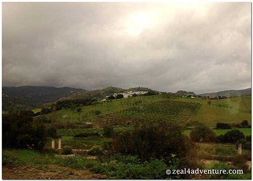
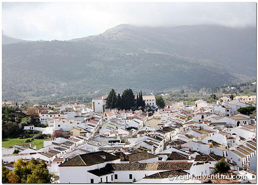
Between the provinces of Malaga and Cadiz, lodged between the valleys and mountains or clustered high on the hillsides within the Sierra de Grazalema Natural Park, lies a cornucopia of sleepy white towns and villages.  Traditionally lime-washed but now painted white houses make up these towns.  Known as the Pueblos Blancos, they create a striking contrast amid a backdrop of rugged limestone mountain.

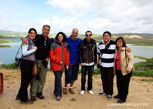
Out of the 6 or 7 noteworthy villages on the Ruta de los Pueblos Blancos, we managed 3 on a rented Opel.

our-route

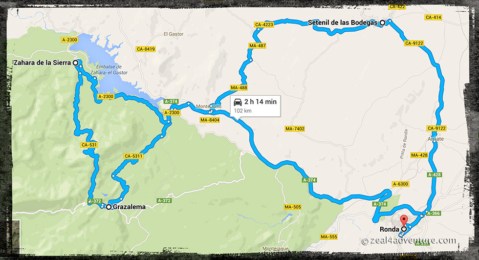
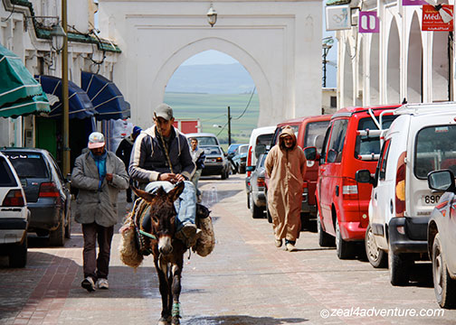
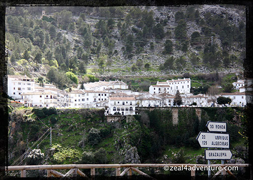
After breakfast, from Ronda we headed north via the A428 and found our way to the first village on our route, Setenil de los Bodegas.

Senetil-white-houses

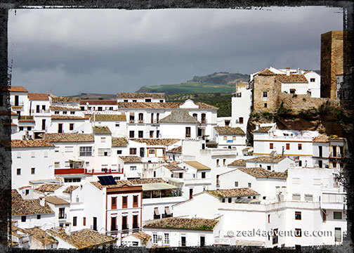
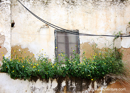
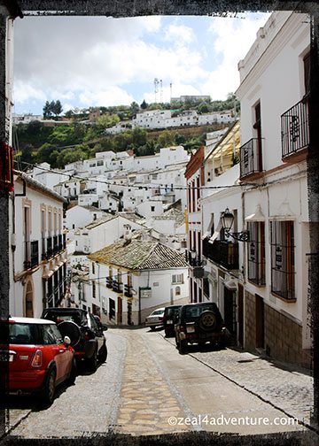
This quaint little village has houses built into rock overhangs above the Rio Trejo, many of which have the rock as its natural roofs and walls.

Setenil structures-built-on-caves

Fetching in an unusual kind of way, this Setenil.

Setenil-narrow-hilly-roads-2

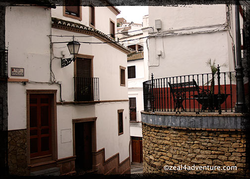
Looking for a place to have a few beers and tapas (as it was nearing lunch time), we discovered that the hilly, winding streets in some parts of town are intimidatingly narrow

Setenil-narrow-hilly-roads

especially if one’s stick shift skills are rusty and the car is rented.

Setenil rocks-make-natural-roof

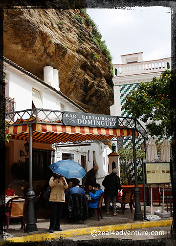
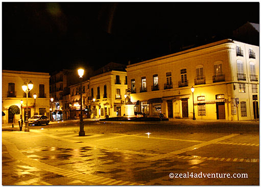
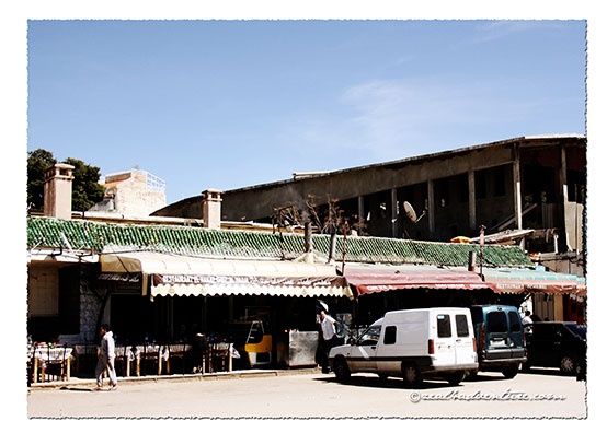
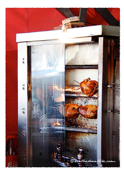
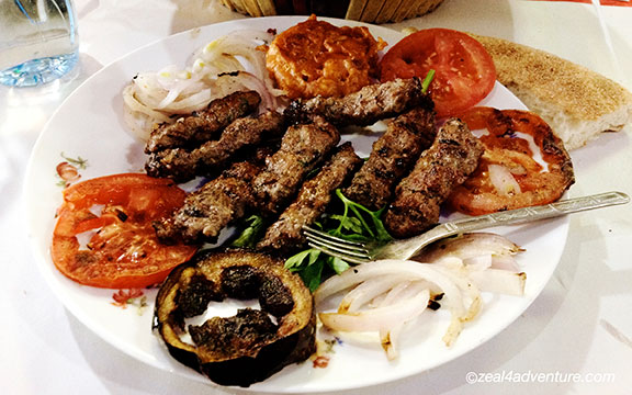
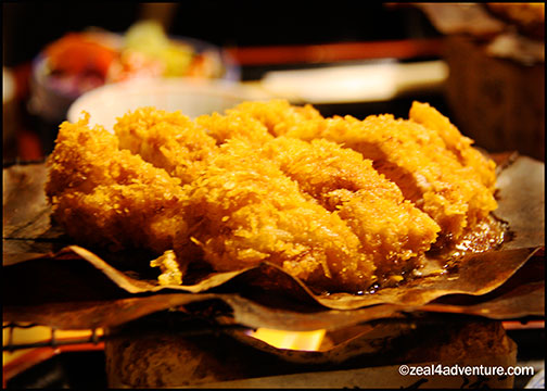
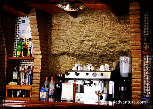
On Plaza de Andalucia, we found Bar Restaurante Dominguez quietly tucked in a corner of Calle Herreria.

Setenil Restaurante-Dominguez

I don’t remember anymore what drew us there (hunger perhaps) but following the recommendation of the owner, lunch was truly satisfying.

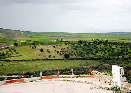
Let me first tell you about this stunning natural park, Sierra de Grazalema.  It was declared a UNESCO Biosphere Reserve in 1977 because it has an exceptional variety of flora and fauna.

Grazalema-limestone-mountain-rangesDo you see the eagle perched on the craggy edge of the limestone?

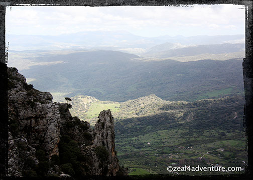
A karstic region set in 51,695 hectares of land that is surrounded by a string of limestone mountain ranges known collectively as… Sierra de Grazalema.  So imagine the spectacular vista of rugged limestone cliffs, and impressive gorges, magnificent forest of rare Spanish firs, and the attractive white towns dotted around the sierra.

Grazalema-from-the-road

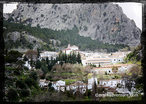
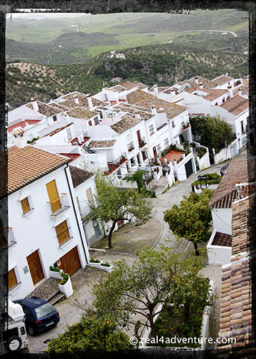
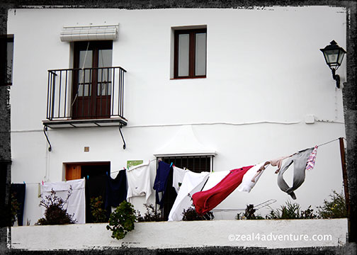
The village of Grazalema is located right at the center of its foothills.  A beautiful white town beneath the craggy peak of San Cristobal.

Grazalema-Plaza-Espana

It has its own charm with a simple central square, the Plaza de España, and cobbled streets lined with whitewashed houses with wrought ironed railing covered windows.

Grazalema-Iglesia-de-la-Encarnacion-from-afar

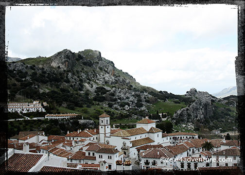
The town has two beautiful churches, Iglesia de la Aurora on Plaza de España and Iglesia de la Encarnacion.  It is an ideal base for those who want to hike the sierra.

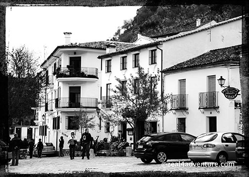
The last village we managed was the most picturesque among the three and a real must.

Zahara overlooking the lake

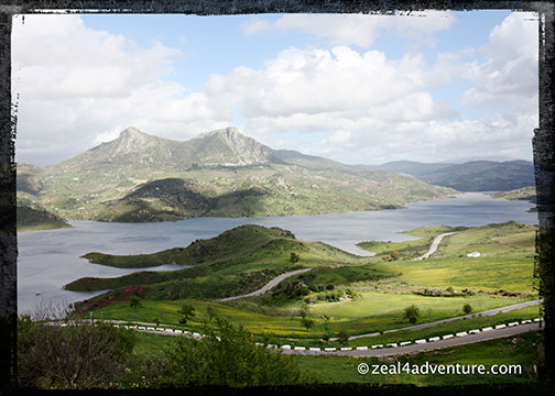
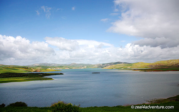
At the northern end of the Grazalema Natural Park, this pueblos blanco overlooks the turquoise water of El Embalse, a huge reservoir that dominates the view from the village perched atop a hill.

Zahara-castle-remains

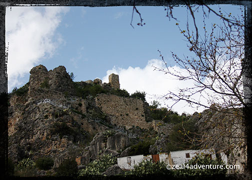
Zahara de la Sierra, once an important Moorish town has the surviving tower of the 12th century Moorish Castle looming over the valley.

Zahara-town-beneath

Scattered below on the slopes are the red-tiled roof whitewashed houses of the village.

This couldn’t be a more outstanding finale to this excursion.  Although we barely scratched the surface, like Ronda, visiting these pueblos blancos gave us a taste of the real Spain, its laid back way of life.

real-spain

Amid such splendor, how can you not stop and smell the flowers?  Cherish its beauty?  Why would you even want to go anywhere?

Useful Info:

Bar Restaurante Dominguez
Plaza de Anadlucia, 11
Setenil de las Bodegas, Cadiz
Contact: +34 956 13 45 31

Magnificent Town of Ronda

Tired from traveling the whole day, but I look out the window of our train plying Mr. Henderson’s railway en route to Ronda and all is well.

view-from-train

The scenery was stunning and the countryside, beautiful.  It was a good decision, taking the train to Ronda as it was a gloriously scenic route.


rock-outcrop

On the plateau of a large rock outcrop stands the magnificent town of Ronda,

rugged-tracts-of-mountains

surrounded by rugged tracts of mountains, the Guadalquivir River running through it.

guadalquivir-river

Gorgeous city steeped in history, set in and around a deep gorge known as El Tajo (the edge),

el-tajo-gorge

and spanned by an astounding 18th century arched bridge,

puente-nuevo

the Puente Nuevo, connecting La ciudad, the old Ronda with the new.

The old quarter charms with cobbled stone streets,

cobbled-stone-streets

lovely churches, striking white houses

Sta.-Maria-la-mayor

and buildings with wrought iron balconies

wrought-iron-balconies

but not to let pass the cafes, tapas bars and restaurants that sprinkle the town.

tapas-bar

For decades, Ronda has been favored by those with a passion for Spanish food and likes to eat well. Tapas, small portions of food, both hot and cold, are served in bars and bodegas to go with a copa de fino (dry Spanish sherry) or beer.

A pleasant and enjoyable way to take in its rich heritage is to wander around town to savor not only the sights but its cuisine as well.

performer

We spent a whole lot of time walking the streets of Ronda, captivated by the spectacular views it offered at every turn. No wonder Welles and Hemingway spent so much time there.  I wish I had taken their cue and spent more time there.

Ronda delivered beyond my expectation.  It was a fantastic kick-off to an Andalusian adventure.

More of Ronda through my lens:

on-the-bridge-to-the-old-townOn the Puente Nuevo
plaza-del-toroPlaza del Toro — Ronda’s bullring known to be the world’s first purpose-built bullring.  The first fight in this bullring took place in 1785 with the famous matador, Pedro Romero and Pepe Hillo.
Iglesia-de-Sta.-Maria-la-MayorIglesia de Sta. Maria la Mayor
white-housesRonda is symbolic of Andalusia’s white town
la-cuidadOn the bridge facing the south side of the gorge, La Ciudad and the heart of Moorish Ronda.
Ronda-at-nightRonda at night.
modern-townPlaza de España— Ronda’s modern ide of the gorge.

The Road to Marrakech

hotel-swiss-chalet-style

Lakes, fountains, wide roads, Swiss-style villas, and green spaces… it’s like driving into a resort town in Switzerland.  But no, we’re still in Morocco, en route to Marrakech.

big-roads-ifrane

king-of-moroccoA photo of Morocco’s King Mohammed VI, a regular sight all around the country.

We took a pit stop in the city of Ifrane in the Middle Atlas, 50 kilometers south of Fes.  Built by the French in the 1930s as a resort town and an oasis in a desert,

the-plaza

a refreshing break from the cramped, dusty alleyways of the medina.

Dayet-Aoua-2

Sitting in a natural depression, Lake Dayet Aoua, is a relatively well-conserved lake within the Parc National d’Ifrane.

Dayet-Aoua

Rich in bird life and woodlands, it is a popular destination of birdwatchers.

The most amazing roast chicken we had on our entire Moroccan adventure was at a roadside restaurant our driver took us to.

roadside-eatery

roasting-chicken

Juicy, succulent with a touch of Moroccan flavors…

roast-chicken

and just thinking of it had me craving for it now.

tagineCarrots, potatoes with beef slow cooked in Moroccan spices.

The vegetable and beef tagine we had with the chicken.

exhibitview-deckview-from-view-deckWe stopped by an exhibit of the Ifrane National Park by the road side.

The trip took 10 hours, 2 hours over the estimated time because, aside from making several stops along the way, the driver took speed limit very seriously.

scenery

This is a typical road scene before I dozed off and woke up in Marrakech at half past eight in the evening, our driver trying to find the Sidi Ben Youssef Mosque, where we are to meet our next host, Adam.

An Outing Outside of Fes: Volubilis

on-fertile-land

It seats on top of some of the most fertile land in the Middle Atlas only 5 kilometers away from Moulay Idriss, situated near Meknes between Fes and Rabat. A site so unexpected, truth to tell.

columns

This Roman ruins consist of no more than half of the original town, but the well-defined remains of its walls,

walls

its intact and intricate mosaics, and the foundation of buildings

IMG_7780

destroyed by a massive earthquake sometime in the 18th century has earned recognition by the UNESCO as an ancient Roman site that houses extensive ruins dating back over 2,000 years.

The Mauritanian capital became an important outpost of the Roman Empire and was adorned with many fine buildings. Already a thriving town, Volubilis grew rapidly under the Roman rule from the 1st century AD onwards.

olive-treesOlive trees still grace the land.

Grains and olive oils, produced in the fertile lands of this province were exported to Rome as well as wild animals for gladiatorial spectacles, contributing to the town’s wealth and prosperity. The last stop of the Roman Imperial roads that went across France, Spain and down to Morocco’s northern city of Tangiers,

the-arc

Volubilis is an exceptionally well-preserved example of a larger Roman colonial town on the fringe of the empire. Its structure comparable to other Roman ruins along the Mediterranean.

IMG_1475

Many, including us, travel to Volubilis to explore the sites’ historical significance. Amongst the ruins, visitors can see a range of public buildings, olive mills, houses, and temples.

mosaic

And because Morocco is a country of mosaic, the rather well-preserved mosaics from the ruins are considered among the finest in existence.

on-a-green-plateau

From the entrance, one can appreciate the green plateau that Volubilis seats on,

view-of-the-Rif-mountains

and when one reaches the site, fabulous views of the Rif Mountains and its surround greets.

So picturesque, Volubilis is picture perfect at any angle. Here’s more of the ruins:

IMG_7829

IMG_7778

IMG_7827

IMG_7823

IMG_7807

An Outing Outside of Fes: Moulay Idriss

Moulay-IdrissCredits: Digital sketch by Jen Caputo (http://jencaputo.typepad.com); Papers from Scrapmatters’ Life’s Little Surprises kit — Happy Scrappy Girl, Graham like the Cracker, Haynay Designs

Seated comfortably in the van, enjoying the company of family and newfound friends,

Lake-ChahandLake Chahand

we marveled at the beauty along the way,

roadside-vendor

even stopping to buy some oranges and dried figs from a roadside vendor.

An hour away from Fes is a picturesque whitewashed town scenically perched in the foothills of the Rif Mountain.

donkeys-and-cars

whitewashed

Moulay Idriss is the first of several destinations planned for the day. Considered the holiest town in Morocco, we paid a visit to the final resting place of the town’s namesake, Morocco’s religious and secular founder and the great-grandson of the prophet Mohamed.

entering-the-mausoleum

His shrine is actually off-limits to non-Muslims, but we were able to go as far as the first courtyard.

first-courtyard

Until 2005, non-Muslims were not permitted to spend the night in town and tourists were advised to be out of town by 3pm. Today, I noticed a few lodgings while walking around.

off-limits-beyond-this-pointThis is where we end the visit to the shrine.  Off limits from here.

The town is considered to be the holiest in Morocco.  They say that, for Moroccans who can’t afford the trip to Mecca, five pilgrimages to Moulay Idriss is equal to one to Mecca.

end-of-town

picturesque-view

Pretty and peaceful with beautiful views across the foothills,

local-market

dried-figs

the village has a charming little souk with stalls selling everything from fruits to live hens.

main-square

And while we were not allowed inside the mosque and shrine, we had fun walking around the main square. It is a great place to people watch while sipping mint tea

kebab

or enjoy a terrific lunch of grilled meats before or after a visit to Volubilis.

Aside from the fact that our driver barely spoke English, Ibrahim confessed to never having explored the town of Moulay Idriss and the nearby city of Volubilis making it the perfect reason to come along.

the-groupNew-found friends flanked: Israeli couple Ronin and wife and Ibrahim

But I think he just really likes us.

Matsumoto

I peered from the balcony of our room, amused by the change of yesterday’s warm hues of autumn.

snow-frm-balcony

Today, I wake up to the white of winter.

Our agenda for the day was to spend it in the castle town of Matsumoto.

snow-on-the-road

The scenery from the bus, now covered with snow, looked different from yesterday.  Then we entered the tunnel and just like that, we were transported back to autumn – quite magical, really.

scenery-enroute

For a moment, I thought I walked into the wardrobe like the characters of the high fantasy novel by C.S. Lewis, The Chronicles of Narnia.  The wonders of this world continue to amaze me.

The ride from Hirayu to Matsumoto was a gorgeous one-hour journey.  Compared to Takayama and Hirayu, Matsumoto’s bigger roads and taller buildings exude a much modern feel despite having one of Japan’s premier historic castles in its midst.

cityscape

That and the Japanese Alps are the main pulls of the town.

matsumoto-castle-moat

The Matsumoto-jo or Matsumoto Castle, as it is simply known, is one of the most complete and beautiful among Japan’s original castles.

matsumoto-black-walls

The 400-year old castle earned the nickname Karasu-jo, the Crow Castle from its striking black lacquered walls

roof

and its roof that resembles wings spread out, boldly standing out against the magnificent backdrop of the Japanese Alps.

view-from-the-topA view of the perimeter of the city from the 5th floor — the strategic office.

The lofty 98-foot structure can be seen from almost anywhere in the central city which makes it easy to find.

Unlike many of the Japanese castles, which is either built on hills or near a river, Matsumoto was built on a plain.  The extraordinarily high strong stonewall, interlinking walls, gatehouses,

view-of-the-moat-from-the-top

and the moat form an extensive system of defense given the lack of natural defenses the castle was built on.  A fascinating design of the castle, which could have been a strategy to keep the floor safe from the enemies, is a floor hidden from the outside.

matsumoto-from-grounds

The 3rd floor has no windows and sometimes called the “dark floor”.  Another feature that could have “defense” in mind is the steep incline and the high rises of the stairs.  This prevents from climbing fast.  In fact, slippery wooden floorboards and socks (as we had to walk around carrying our shoes in a plastic bag) makes for a terrifying climb on those stairs.

Listed as a National Treasure, this well-preserved castle is a good example of a hirajiro, and many of it is still as it was – the moat, the gate, the various bailey and the sub floors minus, however, the furniture and furnishings.  The tenchu or the keep though holds an armory and weapons museum.

It was a nice (warmer) day well spent exploring a well-preserved castle that provided a glimpse of how it was like during Japan’s feudal past,

cityscape-3

walking the streets of this modest size city showcasing a cozy corner of suburban affluence surrounded by mountains,

sushi

and sampling excellent sushi in between.

snow

And through the same tunnel to Hirayu, we found ourselves back in winter.

Useful Info

Matsumoto Castle
4-1 Marunouchi, Matsumoto City
Opening hours:  8:30-17:00 (entrance closes at 16:30)
Fee:  Adults ¥600; Children: ¥300
* It is a 5 minute bus ride or a 15 minutes walk from the Matsumoto Station

Kamikochi: A glimpse of the Japanese Alps

KamikochiCredits:  Template by Jen Caputo; Papers: Designs by Sarah Bennett, Erica Zane, Gwenipooh Designs. Haynay Designs.

Sometimes a change in plans is a good thing.  We arrived in Hirayu Onsen early.  Our room wasn’t ready yet.  “You may want to go to Kamikochi instead”, the front desk clerk recommended to us after she discouraged a trip to the Shin-Hotaka Ropeway, a two-stage tramway that climbs alongside the Hotaka Mountain Range.  She informed us that it had been raining so the visibility will be bad.  “It will also be very slippery”, she added.  We took her word, left our bags with them and headed to the bus station after lunch.

IMG_0828

Long dubbed as the Japanese Alps, Kamikochi is a pristine mountain valley in the Nagano Prefecture, seated at the foot of the Hida Mountains, deep in the Chukusangaku National Park where the Azusa River flows some 1,500 meters above sea level.

IMG_0844

It is known for its splendid landscape and various hiking trails.  As private vehicles have been prohibited in the park since 1996, only buses or taxis are allowed,

IMG_7260

Kamikochi has become one of the best-protected natural areas of Japan despite the droves of tourists and hikers that flock there.

The scenic bus ride from Hirayu Onsen to the Kamikochi parking lot took all of 30 minutes with a brief stop at Taisho Pond for those wanting to hike to the center of Kamikochi. Since it was drizzling and freezing and we weren’t in proper attire, not to mention that we only had half a day, we passed.

trail-from-taisho

It is the best way to enjoy a day in Kamikochi actually, and on hindsight, I am not sure we made the right decision to forego the hike.

trail-to-bridge

From the parking lot, we took our time and marveled at the wondrous views of some of the tallest peaks of Central Japan’s Northern Alps as we followed the trail to the Kappabashi Bridge.

kappabashi

This wooden suspension bridge is a symbol of Kamikochi with the most gathering of visitors.

IMG_7253

From the bridge, one can see the surrounding mountains, Nishihotakadake, Okuhotakadake, Myojindake, and the active volcano Yakaedake – all towering summits over 3,000 meters above sea level.

coffee-and-dessert

Though we barely scratched the surface with just half a day, less actually if you take out the time we spent indoors to warm ourselves with coffee and dessert, Kamikochi has instantly become a personal favorite, and I wouldn’t mind spending a few days wandering around should there be a next time.

IMG_7251

So sometimes a change in plans is indeed a good thing.

Shirakawa-go

ogimachi-gassho-house

Gassho-zukuri.  We’re not done talking about it yet because there are still some that can be found in typical farming villages, some ordinary folks still call it home, this 250-year old special farmhouses.

omigachi-collage

These villages still exist, and one is just 50 minutes away by bus from Takayama.

ogimachi-tourists

The UNESCO declared World Cultural Heritage Site, Shirakawa-go and its neighboring region Gokayama has been slowly attracting visitor since it was inscribed in 1995.

Ogimachi is Shirakawa-go’s largest community.  A charming village, albeit a slightly “touristy” oriented one, lining the Shogowa River valley.

Ogimachi-scenery

Its beauty lies not only in the scenery, resplendent in shades of autumn at the time of visit, but as well as in its community.  Ogimachi has 2 medical clinics, a primary school and a junior high school.

Ogimachi-fixing-roof

Many still live in a Gassho-zukuri, but many of the well-preserved farmhouses have become museums, restaurants and there are 20 or so of it that has been made into Minshuku (bed and breakfast) guesthouses.

lunch-shiraogi

Time permitting; spending a night there would have been glorious.  Instead, we contented ourselves to a nice hot soba meal before heading back to Takayama.

Ogimachi-crossing-the-shogawa-river

Across the bridge, near the bus stop is a well-constructed outdoor heritage museum.

minkaen-collage

The Gassho-zukuri Minkaen features 25 preserved farmhouses.

minkaen-1

Like Hida-No-Sato, it was relocated and rebuilt to emulate a traditional village in the countryside, scenery and landscape of which is simply superb with the mountains lending the perfect backdrop.

minkaen-2

A Feast for the Eyes and Soul

Hida-No-SatoCredits:  Template by K Pertiet (Bears Life)

I love how the Gassho-Zukuri farmhouses stand out against the warm hues of autumn – a stunning contrast, really.  This tall (possibly 3-4 stories high) coffee-colored A-shaped thatched roof farmhouses were first built during the Edo period.

entrance

Lush woodland with hints of fall reflects on the stillness of the pond like a mirror.  It reminds me of a Monet artwork except that the setting isn’t France.  This is the first thing your eyes will wander to once you enter Hida No Sato, sometimes also called Hida Folk Village.

gassho

And this is where those Gassho houses were relocated.  It resembles a village of old Japan – it has around 30 well-preserved traditional houses, storehouses and other structures with farming tools and everyday utensils displayed in each house.

Tanaka's-House

This outdoor museum of sort, aside from preserving the structures, strives to keep the culture alive by offering hands-on lessons on the traditional way of life like rice cropping, straw-work and stitching, cypress carving to even storytelling using the local dialect.

interior

A few hours here will boost your appreciation on how life was back then for farmers and craftsmen of the Hida region.

IMG_7176

Life isn’t easy for these people as winter is harsh in this part of Japan.  The steep slanting roof was said to be for the purpose of rain and snow.  It allows both to fall straight off, preventing water from seeping through the roof or heavy snow collapsing the roof.  It also eases the work of cleaning. Isn’t it amazing how a practical need has led to a fascinating and unique style of architecture?

autumn-colors

So when in Takayama, you must go visit this place.  It’s just a 30-minute walk from town or a 10-minute bus ride from the Takayama Station.  It will be a feast for the eyes and the soul.

Useful Info

Hida No Sato
1-590 Kamiokamoto-machi, Takayama City
Opens 7 days a week from 8:30am – 5:00pm
Admission: ¥700
 
How to get there from Takayama:
Take a 10-minute bus ride from the Takayama Station (bus runs every hour); get off at the Hida No Sato bus stop. 

Old Town Splendor

It was close to lunch when we hailed a taxi at the Takayama Station to take us to Futurishizuka Hakuun, our Ryokan.  Not exactly at the center of town but Takayama is small enough to go around on foot anyway.  A leisurely walk to town took us about 15 minutes to Le Midi,

Hida-beef-at-Le-Midi

a French bistro recommended by the Ryokan, for an excellent Hida beef meal.

Lesser known internationally, the Hida region of Gifu Prefecture breeds top quality black cattle.  As a mater of fact, it was given the highest prize by the same award giving body that made Kobe beef what it is today.  And when in Takayama and the surrounding areas around the Hida region, a Hida beef meal should be high on your list.

But more than Hida beef, Takayama is visited for its famous historic townscape.

sanmachi-2

At the center of town, old wooden houses from the Edo period line both sides of the streets of Sanmachi imparting an atmosphere straight from the 19th century.

restaurant-in-traditional-building

Most of these are still private homes while a few are now shops, inns, and restaurants.

shop

Many museums, galleries, and even sake breweries likewise coexist with the old private houses in that quarter.  The three narrow streets that form Sanmachi are “Nationally Recognized Important Historical Preservation Areas”.

Takayama was the center of Japan’s timber industry and was known for its expertise in carpentry.  It is believed that carpenters from this town worked on palaces and temples in Kyoto and Nara hence the well-preserved quarter.

black-houses

The striking black luster of the buildings were the result of rich merchants back then trying to hide the use of the best but prohibited wood by painting their houses with soot, which in my opinion gave the city its character in the end.

traditional-buildings

The old town is where the action is; just a short distance from each other is where most of the attractions are.

scenic-town

And for the remaining portion of the day, we walked around town not exactly aimless but with a loose agenda, and this was where our meanderings took us:

Takayama Matsuri Yatai Kaikan

Ranked as one of Japan’s most beautiful festival, the Takayama Matsuri Festival always attracts a large number of spectators.  Magnificent floats are pulled through the streets of Takayama’s old town during the festival held every spring and autumn.

Festival Floats Exhiibit Hall

The Takayama Matsuri Yatai Kaikan or the Festival Floats Exhibition Hall displays on rotation four of the eleven floats used in the festival.  Many of the floats that date back from the 17th century are of gilded wood intricately carved with detailed decorative metalwork.  If not displayed in the hall, they are stored in tall storehouses called yatai-gura scattered quite noticeably around the town.  And these elaborately crafted floats are excellent showcases of the special skills the Hida-Takayama craftsmen are known for.

Sakurayama Hachiman Shrine

Sakurayam-shrine

Just across the exit of the exhibition hall is the shrine where the Matsuri Festival is held every year. It was built during the time of Emperor Nintoku and later made bigger than the original under Lord Kanamori.  It was officially established to protect a part of Takayama,

Sakurayama Nikko Kan

The Nikko Toshogu is a Shinto shrine in Nikko Tochigi Prefecture dedicated to the first shogun of the Edo Shogunate, Tokugawa Ieyasu, a UNESCO World Heritage Site.  The Shogunate spent a fortune and took 15 years to reconstruct the Toshogu.

sakurayama-nikko-kan

The entrance fee of the Matsuri Yatai Kaikan includes the Sakurayama Nikko Kan, a hall displaying the impressive one-tenth scale replica of the Nikko Toshogu.

sakurayama-nikko-kan-2

The replica, after the war, was shown in the United States and in a few decades later, in Japan.  Today, it has found its home at the Sakurayama Nikko Kan complete with a computerized lighting system programmed to alternate sunrise to sunset.  It is a beautiful exhibit not to be missed.

Yoshijma Heritage House

Built by master carpenter Nishida Isaburo in 1907.  The Yoshijima family was a prosperous merchant engaged in money lending and the production of sake in Takayama.  And it once had a building where sake once brewed and plastered storehouses where sake was stored before being sold.  Unfortunately, most of the structure has been torn down with only a small part remaining.

yoshijima-heritage-house

Well maintained, the house has posts and beams polished and smoothened through the years to a rich brown tone delivering a sense of sophistication to an already beautiful old house.  Another a must see.

As we continue to explore the town, we decided on an early dinner of Tonkatsu.

tonkatsu

Unlike the ordinary Tonkatsu we know, this deep-fried breaded pork fillet is placed on top of a magnolia leaf with the sweet sauce heating on a dish with fire underneath. Tender and juicy, this meal was the perfect way to end the exploration.

Back in our Ryokan, we reveled at our ante room, put our feet up, and sipped our green teas.  We were in good spirits.

green-tea

I wasn’t planning to, but the hot tub was calling out to me.

Futarishizuka-Hakuun

Nestled on a hill, Futurishizuka Hakuun is favored with a wonderful view of the city and mountain.  It has in some rooms a private hot bath.  And our tub has that view – beats having a massage any day.

hot-bath

As I lay down in the tub, I see steam all around, and I feel heat melting the weariness from all the walking done the past few days.  Knowing that there will be more, I welcome this tonight.  And maybe tomorrow too.

Useful Info:

Yoshijima Heritage House
Hours: 9:00AM to 5:00PM (Mar – Nov); 9:00AM to 4:30PM (Dec – Feb)
Closed on Tues (Dec – Feb, when Tue falls on a national holiday, it is open and is closed the following day)
Admission: ¥500
 
 
Festival Floats Exhibition Hall & Sakurayama Nikko Kan
Hours: 8:30AM to 5:00PM (Mar – Nov); 9:00AM to 4:30AM (Dec – Feb)
Admission: ¥820